
Rob-n-Hild Take the High Road!
Click links to jump to specific days:
Start | Nerdy
| Stranger Things
| Stairs Stairs Stairs
|
|||||||||||||||||||||||||||||||||||||||||||||||||||||||||||||||
|
Thurso to Dunnet Head to Gairloch We drove 326 km in 5:41 hours, max altitude 329 meters, but a lot of up and down - 3,400 metresĀupĀ(andĀdown). 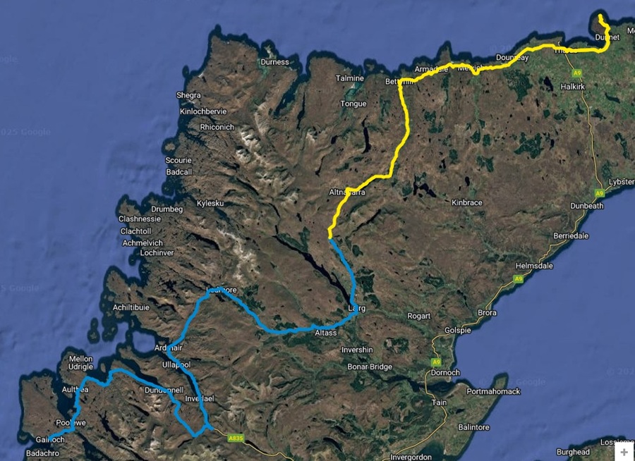
|
|||||||||||||||||||||||||||||||||||||||||||||||||||||||||||||||
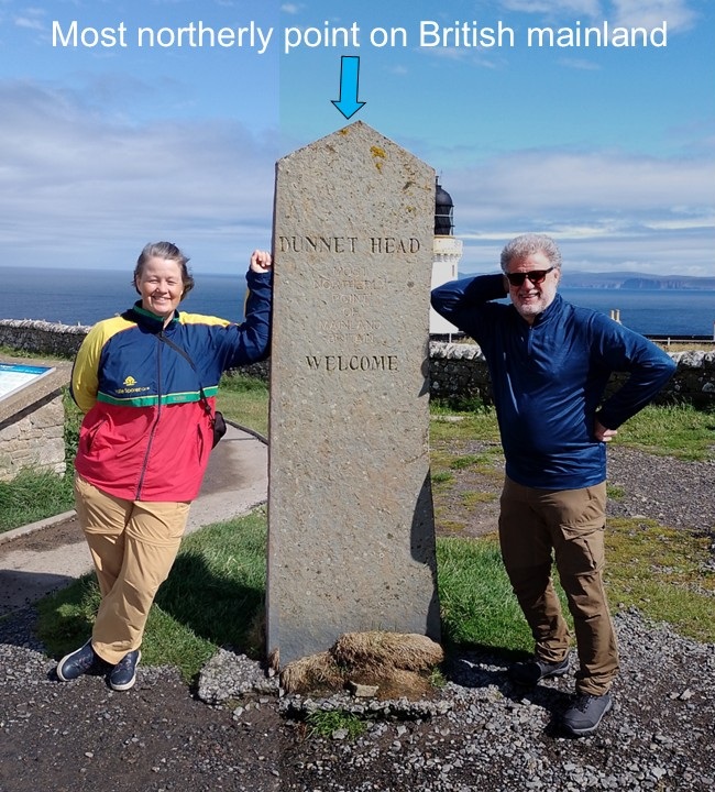
| We decided to back-track a bit and go to Dunnet Head since it is famously the most northerly point on the British mainland. | |||||||||||||||||||||||||||||||||||||||||||||||||||||||||||||||
|
|||||||||||||||||||||||||||||||||||||||||||||||||||||||||||||||
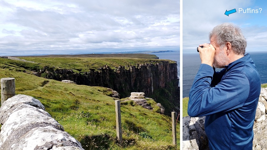
| We didn't know much more about the place, and were excited to find more bird colonies to look at. Rob was in serious puffin-spotting mode. | |||||||||||||||||||||||||||||||||||||||||||||||||||||||||||||||
|
|||||||||||||||||||||||||||||||||||||||||||||||||||||||||||||||
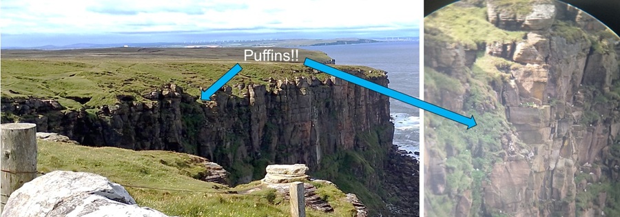
| Whoo-hoo! We saw lots of puffins. As usual our cameras are useless to prove our sightings - even when using our binocular as "telephoto lens". | |||||||||||||||||||||||||||||||||||||||||||||||||||||||||||||||
|
|||||||||||||||||||||||||||||||||||||||||||||||||||||||||||||||
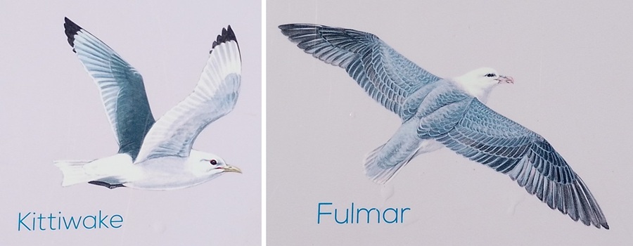
| It has been a constant confusion for us how to tell the difference between a Fulmar and a Kittiwake. So we include two drawings of them and figure that our best bet is to decide by the black wingtips of the Kittiwake. | |||||||||||||||||||||||||||||||||||||||||||||||||||||||||||||||
|
|||||||||||||||||||||||||||||||||||||||||||||||||||||||||||||||
|
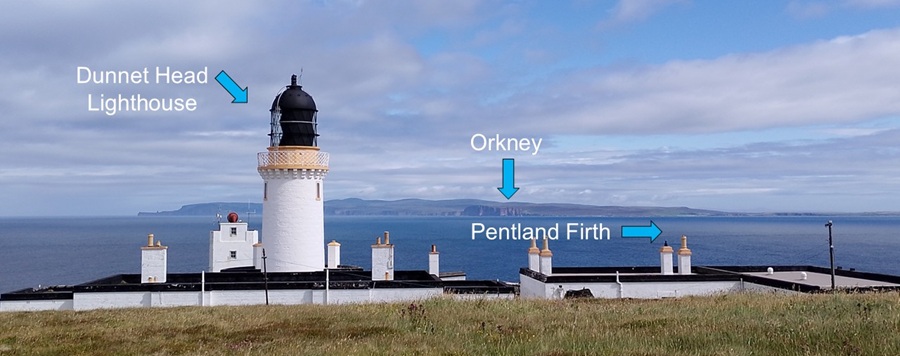
The Dunnet Head lighthouse is yet another one built by a famous
Stevenson family member. This time it was Robert Stevenson - grandfather
of Treasure Island author Robert Louis Stevenson. The lighthouse was
established in 1831, but it was automated in 1989. The other buildings
are from the Second World War when this was a Coast Defence U-boat
station.
We got another look at the dreaded Pentland Firth, and the beautiful Orkney Islands in the distance. |
|||||||||||||||||||||||||||||||||||||||||||||||||||||||||||||||
|
|||||||||||||||||||||||||||||||||||||||||||||||||||||||||||||||
|
Next, we drove west and south to a B&B in Gairloch. To our surprise a
large portion of our trip today was on single-lane roads with
too few passing places. They should learn from Shetland and do it
properly.
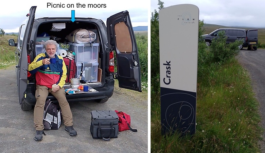
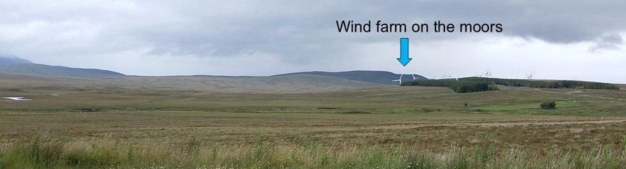
It took us until about 1 pm to find a place to stop - not just to pass a car - and have lunch. We chose a parking lot at Crask. Crask is in the middle of a significant blanket bog and moorland covering much of Caithness (where we had just been around John O'Groats) and Sutherland (where we were enjoying our picnic today). It is known as the Flow Country. It can't be very protected as we spotted a windfarm right smack bang in the middle. |
|||||||||||||||||||||||||||||||||||||||||||||||||||||||||||||||
|
|||||||||||||||||||||||||||||||||||||||||||||||||||||||||||||||
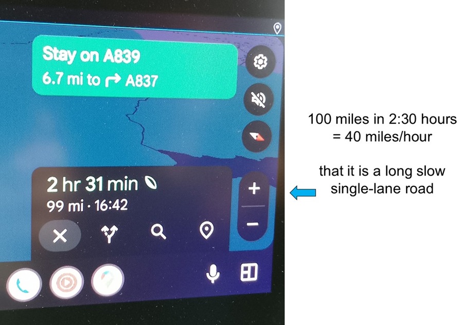
| The single-lane road was slower than expected. At one point we had 100 miles to go, and Google estimated 2:30 hours. Average speed of 40 miles/hour is not fast - and it turned out to be an accurate estimate. | |||||||||||||||||||||||||||||||||||||||||||||||||||||||||||||||
|
|||||||||||||||||||||||||||||||||||||||||||||||||||||||||||||||
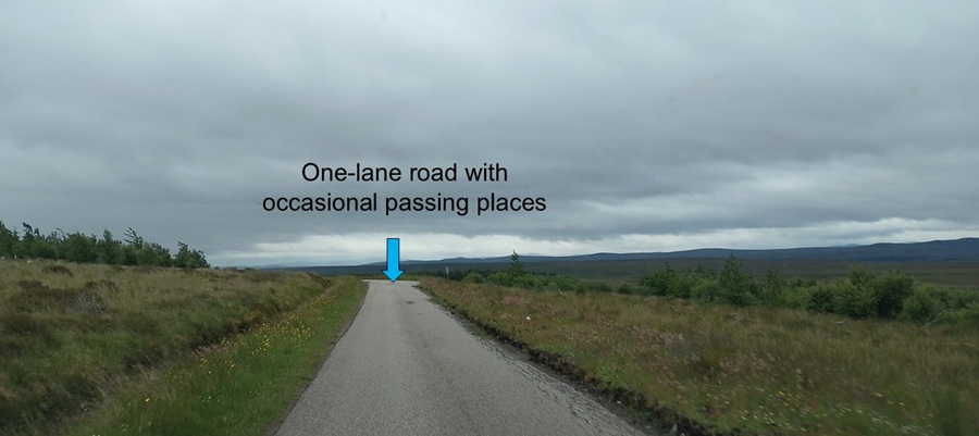
| Our single-lane road looked much like this - with way too few passing places. | |||||||||||||||||||||||||||||||||||||||||||||||||||||||||||||||
|
|||||||||||||||||||||||||||||||||||||||||||||||||||||||||||||||
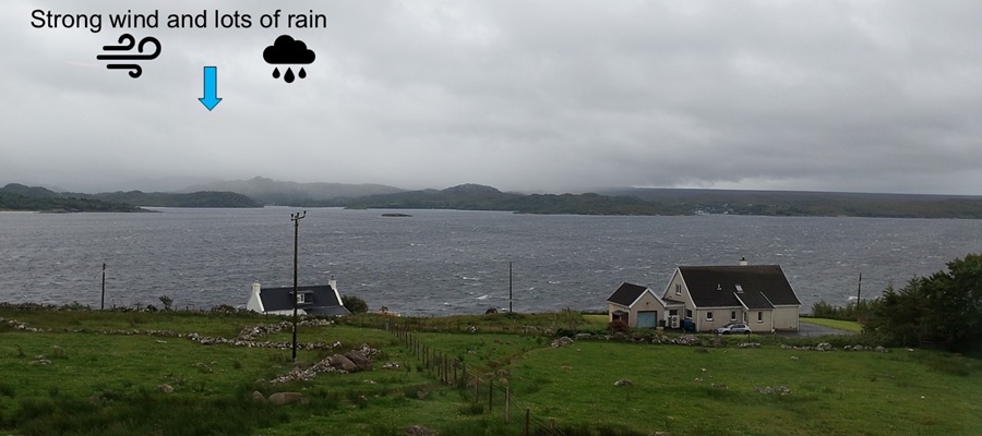
| We arrived in Gairloch with bad weather - strong winds and lots of rain. We were not tempted to explore any further tonight. | |||||||||||||||||||||||||||||||||||||||||||||||||||||||||||||||
|
|||||||||||||||||||||||||||||||||||||||||||||||||||||||||||||||
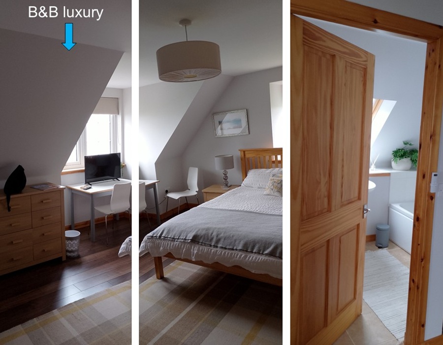
| Having studied the weather forecast with strong winds, we had already booked a night at a B&B. It was nice to be dry, watch some TV, have dinner, and do some work. | |||||||||||||||||||||||||||||||||||||||||||||||||||||||||||||||
|
|||||||||||||||||||||||||||||||||||||||||||||||||||||||||||||||
| Coming up: Aultbea | |||||||||||||||||||||||||||||||||||||||||||||||||||||||||||||||
Start
| To Previous Day
| To Next Day
| Nerdy
| Stranger Things
| Stairs Stairs Stairs
May-July 2025
May-July 2025