
Rob-n-Hild Take the High Road!
Click links to jump to specific days:
Start | Nerdy
| Stranger Things
| Stairs Stairs Stairs
|
|||||||||||||||||||||||||||||||||||||||||||||||||||||||||||||||
|
John O'Groats - Duncansby Head 9.77 km in 4:00 hours including 2 hours stopping time. We climbed 248 m with maxĀheightĀ70Ām. 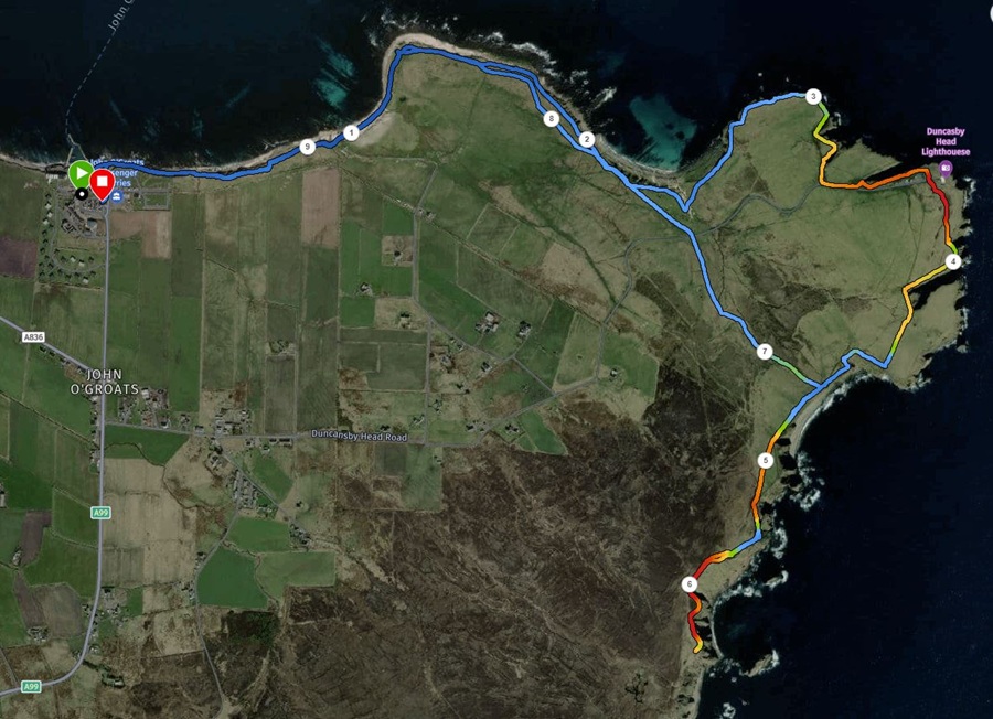
|
|||||||||||||||||||||||||||||||||||||||||||||||||||||||||||||||
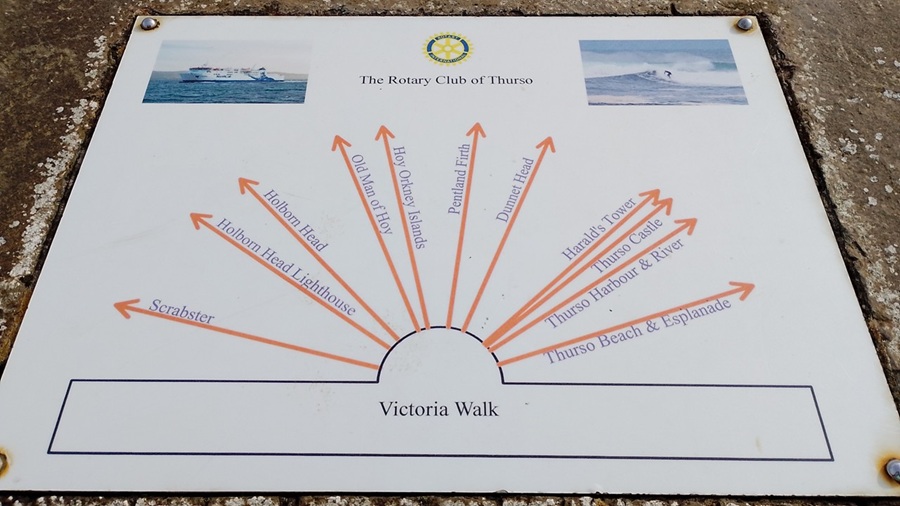
| Before doing our big hike at John O'Groats, we did a morning walk from our campsite to Tesco. There is a nice coastal path that goes straight past our campsite, so we joined it. It is called Victoria Walk. You can walk all the way from Scrabster in the west (where the ferry goes to Orkney) to downtown Thurso. | |||||||||||||||||||||||||||||||||||||||||||||||||||||||||||||||
|
|||||||||||||||||||||||||||||||||||||||||||||||||||||||||||||||
|
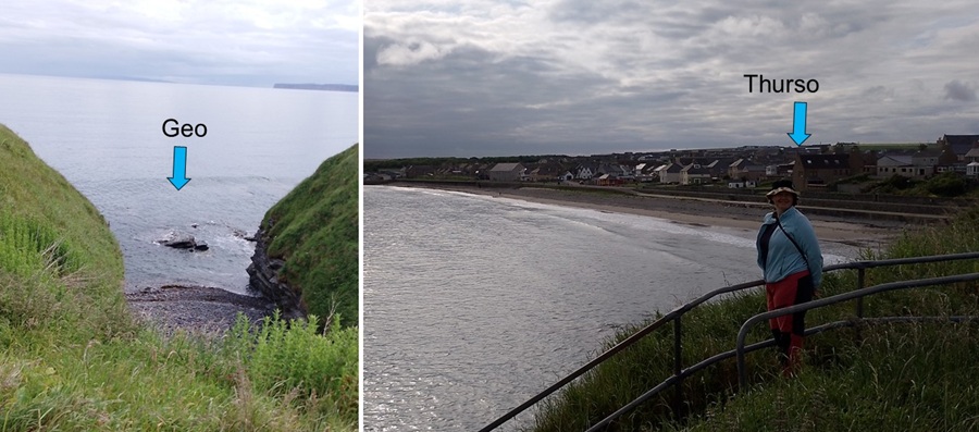
We saw a small geo (a narrow and deep cleft in the cliff face) as soon as
we started walking. Now we check all of these geos for fun things like seals
and otters. However, we have had no luck yet.
The view over Thurso Beach is nice and reminds us a bit of Cornwall. |
|||||||||||||||||||||||||||||||||||||||||||||||||||||||||||||||
|
|||||||||||||||||||||||||||||||||||||||||||||||||||||||||||||||
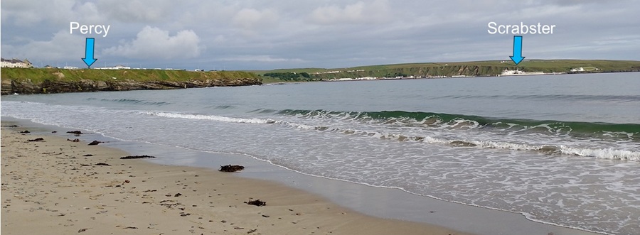
| From Thurso Beach we could look back at our campsite and all the way to Scrabster. | |||||||||||||||||||||||||||||||||||||||||||||||||||||||||||||||
|
|||||||||||||||||||||||||||||||||||||||||||||||||||||||||||||||
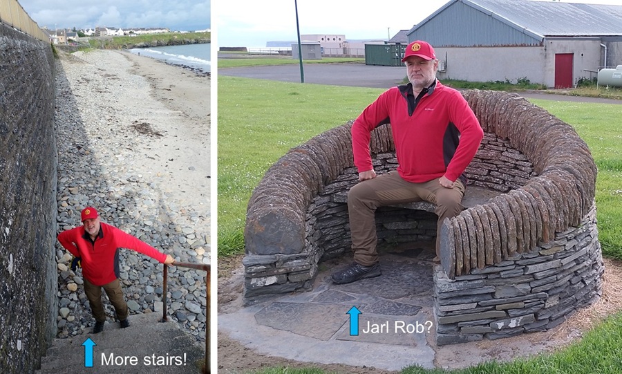
| Rob found another set of stairs to climb up off the beach. That called for a quick rest at a very throne-looking chair. He was channelling King Eric (Cantona). | |||||||||||||||||||||||||||||||||||||||||||||||||||||||||||||||
|
|||||||||||||||||||||||||||||||||||||||||||||||||||||||||||||||
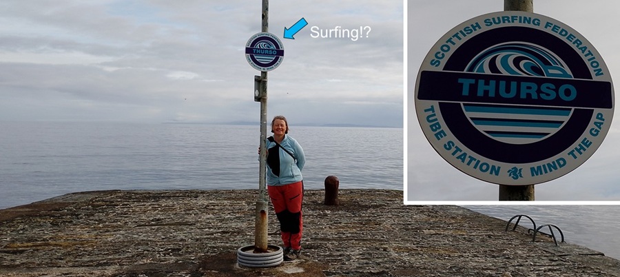
| Hild was more fascinated to find that there is such an entity as the "Scottish Surfing Federation" and that they have a "Tube Station" at Thurso! Tee-hee. | |||||||||||||||||||||||||||||||||||||||||||||||||||||||||||||||
|
|||||||||||||||||||||||||||||||||||||||||||||||||||||||||||||||
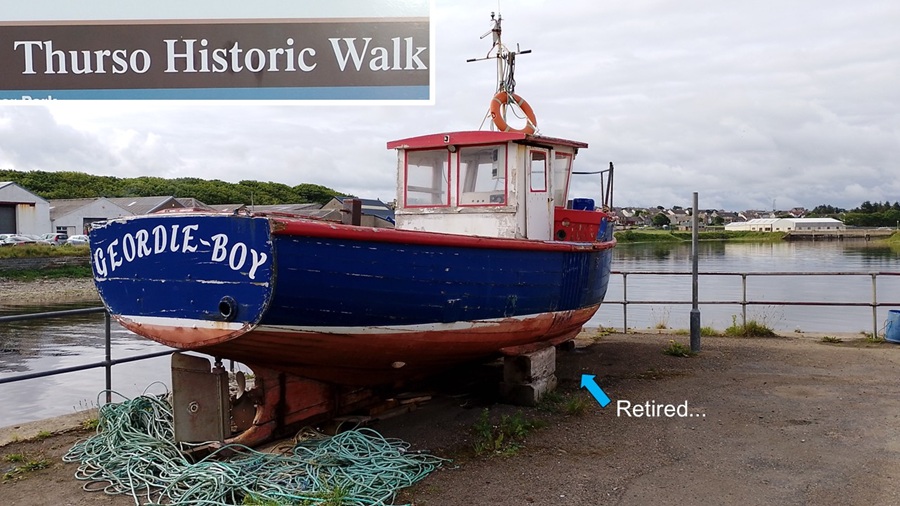
| We followed signs and information plaques for Thurso Historic Walk. It had certainly been a happening place in the past until the 1800s. Fishing industry as well as flag stone production (!). There were many derelict fishing boats and buildings on the harbour. | |||||||||||||||||||||||||||||||||||||||||||||||||||||||||||||||
|
|||||||||||||||||||||||||||||||||||||||||||||||||||||||||||||||
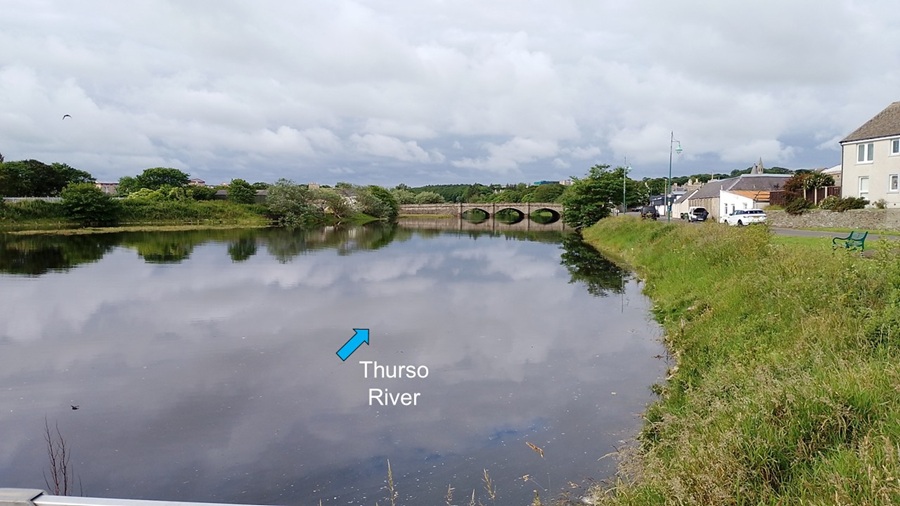
| The current road bridge across Thurso River was first built in 1800, and then they built a new and wider bridge in 1887. We don't think it is particularly wide anymore, but seems to work ok and it is beautiful. | |||||||||||||||||||||||||||||||||||||||||||||||||||||||||||||||
|
|||||||||||||||||||||||||||||||||||||||||||||||||||||||||||||||
|
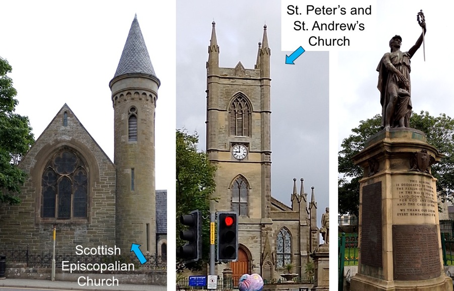
Walking back through downtown Thurso we admired the round spire of
the Scottish Episcopalian Church - very unusual - and the square bell tower
of St. Peter's and St. Andrew's Church. Unfair that they had to share a church,
we think.
This is also the location of the war memorial. |
|||||||||||||||||||||||||||||||||||||||||||||||||||||||||||||||
|
|||||||||||||||||||||||||||||||||||||||||||||||||||||||||||||||
|
Back home in the tent we enjoyed a cup of tea before setting off on our
main adventure: Driving to John O'Groats to walk past the north-eastern most point of
mainland UK. We learnt about Jan de Groot who lends his name to the place. He was
Dutch and ran a ferry to Orkney and charged 2 pence a trip. He built a bit of an empire
and a grand house. He had many family members lining up for a share of his wealth.
He built an eight-sided house and eight-sided oak table so that all those grasping
for wealth could sit at the "head of the table". Tee-hee.
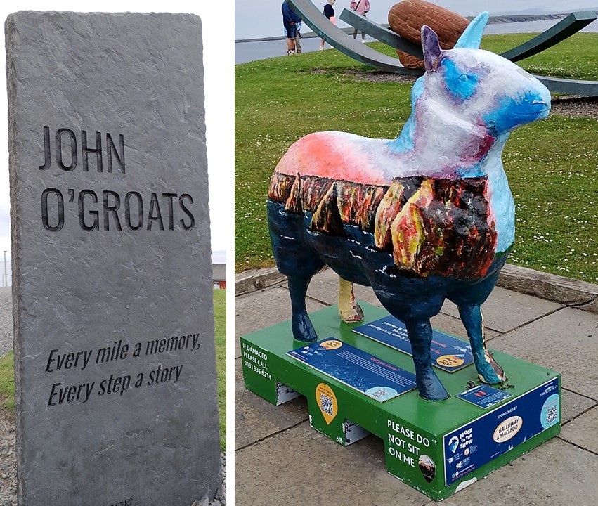
There are several gift stores and coffee shops at the car park, but we just took a photo of this artful sheep and moved on. We made sure we didn't ride the sheep as instructed by the stickers. |
|||||||||||||||||||||||||||||||||||||||||||||||||||||||||||||||
|
|||||||||||||||||||||||||||||||||||||||||||||||||||||||||||||||
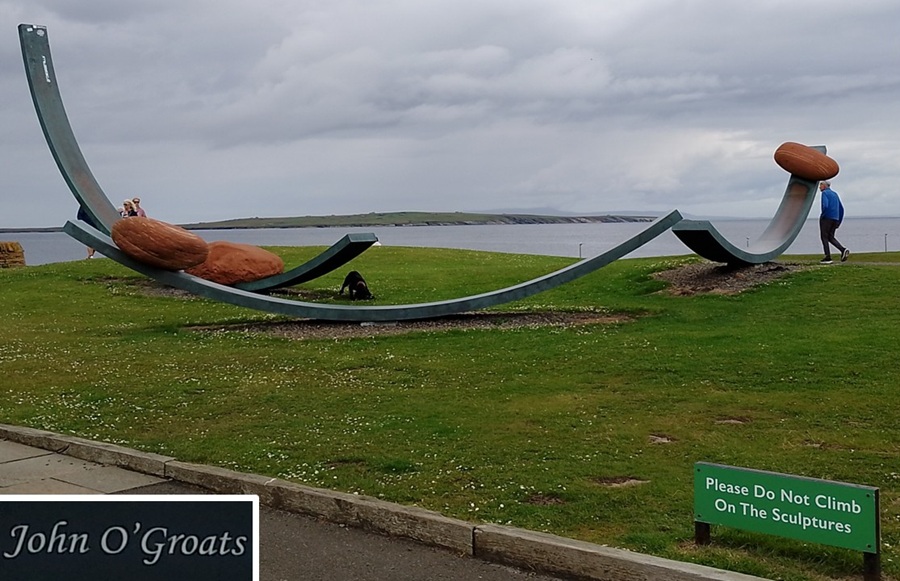
| There was also this art installation which we mustn't climb. Not sure what the art signifies but it is cool-looking anyway. | |||||||||||||||||||||||||||||||||||||||||||||||||||||||||||||||
|
|||||||||||||||||||||||||||||||||||||||||||||||||||||||||||||||
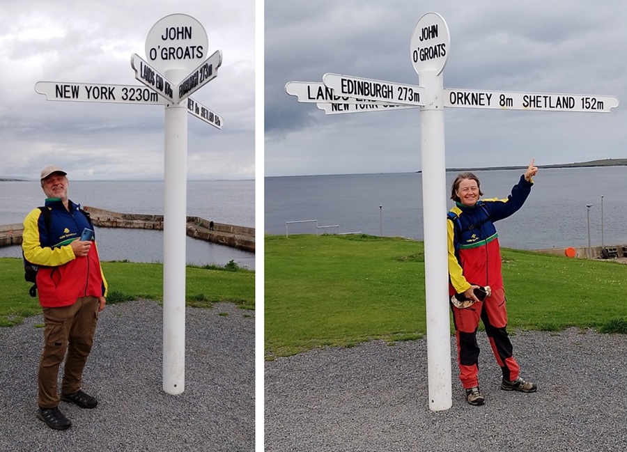
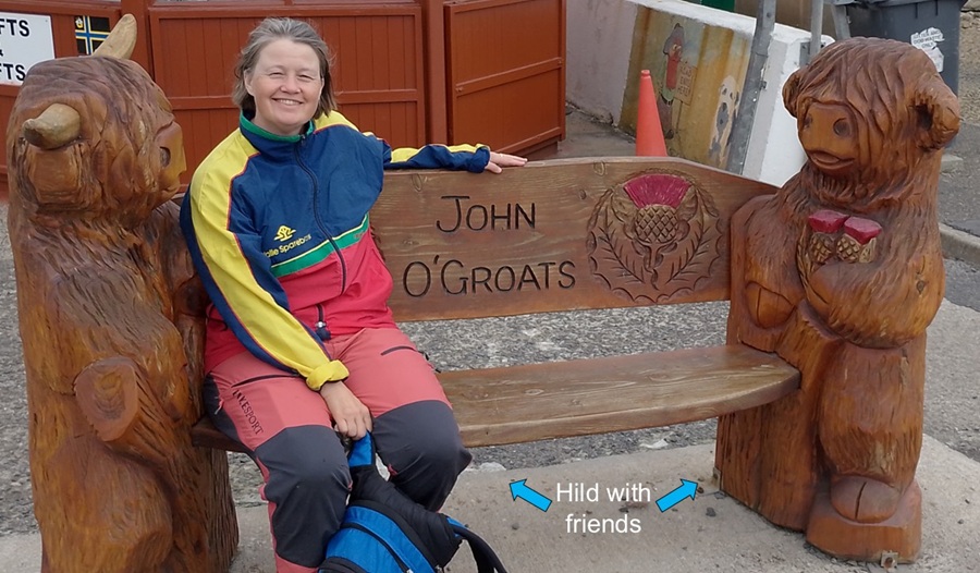
| We had our photos taken at the famous John O'Groats distance sign. Rob had a giggle of the 3,230 miles to New York and 874 miles to Lands End in Cornwall. Hild observed the 8 miles to Orkney and 152 miles to Shetland. | |||||||||||||||||||||||||||||||||||||||||||||||||||||||||||||||
|
|||||||||||||||||||||||||||||||||||||||||||||||||||||||||||||||
| Hild found this bench held up by cute highland cattle carved in wood. | |||||||||||||||||||||||||||||||||||||||||||||||||||||||||||||||
|
|||||||||||||||||||||||||||||||||||||||||||||||||||||||||||||||
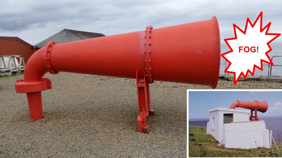
| This foghorn was moved from the Duncansby Head Lighthouse in 2000 when it wasn't needed anymore. The foghorn would sound whenever the fog was so dense that ships couldn't see the light from the lighthouse. Hild was relieved that it wasn't a working foghorn, because it would be so loud to stand next to it when it went off. | |||||||||||||||||||||||||||||||||||||||||||||||||||||||||||||||
|
|||||||||||||||||||||||||||||||||||||||||||||||||||||||||||||||
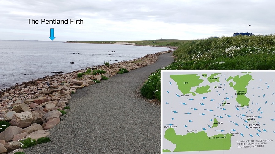
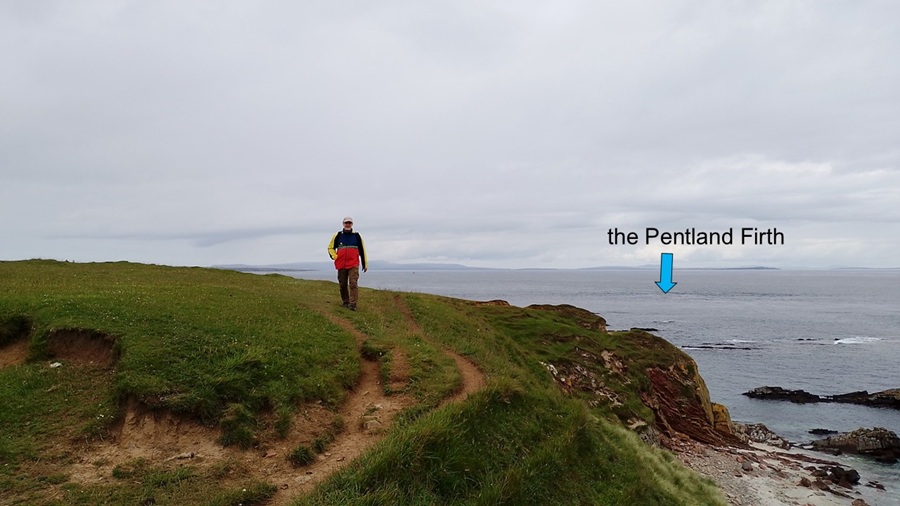
| As we headed east along the coastal path from John O'Groats we looked at the calm waters towards Orkney. Having said that, it was only calm because it was at the peak of high tide in beautiful weather. This strait is known as the Pentland Firth and is one of the most dangerous stretches of water in Britain. The tidal currents, rips and whirlpools have resulted in many shipwrecks and claimed many lives. | |||||||||||||||||||||||||||||||||||||||||||||||||||||||||||||||
|
|||||||||||||||||||||||||||||||||||||||||||||||||||||||||||||||
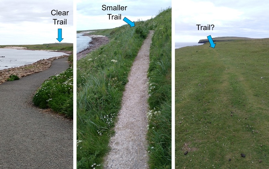
| The quality of the trail changed a lot during the day: from wheelchair accessible to gravel and dirt to "trail, what trail?". Thankfully, we were walking through areas with where many sheep had walked before us - and made nice sheep trails! Good childhood memories for Hild. | |||||||||||||||||||||||||||||||||||||||||||||||||||||||||||||||
|
|||||||||||||||||||||||||||||||||||||||||||||||||||||||||||||||
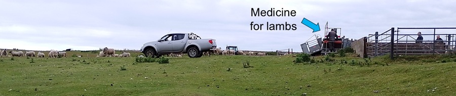
| The lambs were not so happy today. As we got to one of the fields along our trail, the farmer was moving many sheep from one field to another. He was taking the opportunity to give some lambs medicine. It looked like an oral dose of worming medicine. It was interesting to watch the farmer operating a gate using his foot so as to catch only those lambs that should have the medicine. | |||||||||||||||||||||||||||||||||||||||||||||||||||||||||||||||
|
|||||||||||||||||||||||||||||||||||||||||||||||||||||||||||||||
|
Because the lambs and sheep were busy panicking from losing each
other, we took an alternative route so as not to make things worse.
The animals would probably run screaming for the hills if they saw us coming
in our brightly coloured Valle jackets.
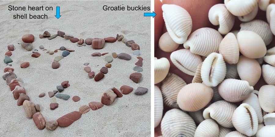
We walked on Shell Beach which was clearly all broken shells rather than actual sand. Apparently, you can find a "Groatie Buckie" (Trivia arctica) or a "lucky shell", but we didn't look very carefully for these shells. Just as well, since if you collect too many your luck disappears... Eeek! We did find that someone else had built a heart out of stones, no shells in sight. |
|||||||||||||||||||||||||||||||||||||||||||||||||||||||||||||||
|
|||||||||||||||||||||||||||||||||||||||||||||||||||||||||||||||
| The coastal trail was fun and easy to walk. We followed the paths made by sheep and tourists. Keeping an eye on the Pentland Firth, it was maybe starting to get a bit wilder as the tide turned. | |||||||||||||||||||||||||||||||||||||||||||||||||||||||||||||||
|
|||||||||||||||||||||||||||||||||||||||||||||||||||||||||||||||
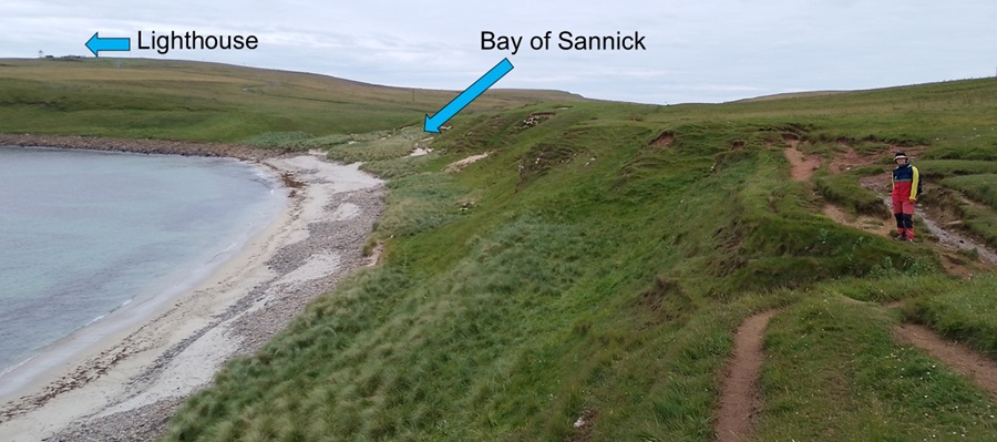
| We walked past the Bay of Sannick toward the lighthouse in the distance. | |||||||||||||||||||||||||||||||||||||||||||||||||||||||||||||||
|
|||||||||||||||||||||||||||||||||||||||||||||||||||||||||||||||
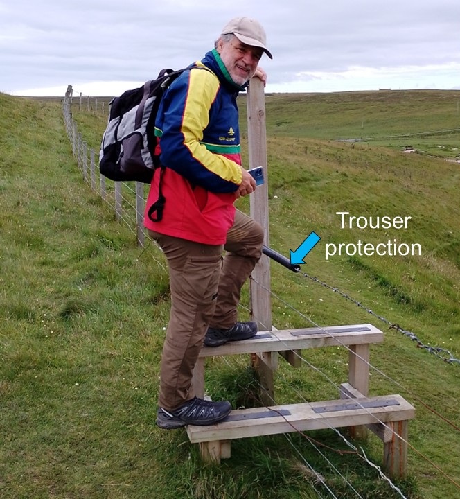
| At the next stile we had to climb over metal fence with barbed wire on the top. The farmer (or someone else) had put some rubber tubing to cover the barbed wire. Nice protection for tourist-trousers... Thank you! | |||||||||||||||||||||||||||||||||||||||||||||||||||||||||||||||
|
|||||||||||||||||||||||||||||||||||||||||||||||||||||||||||||||
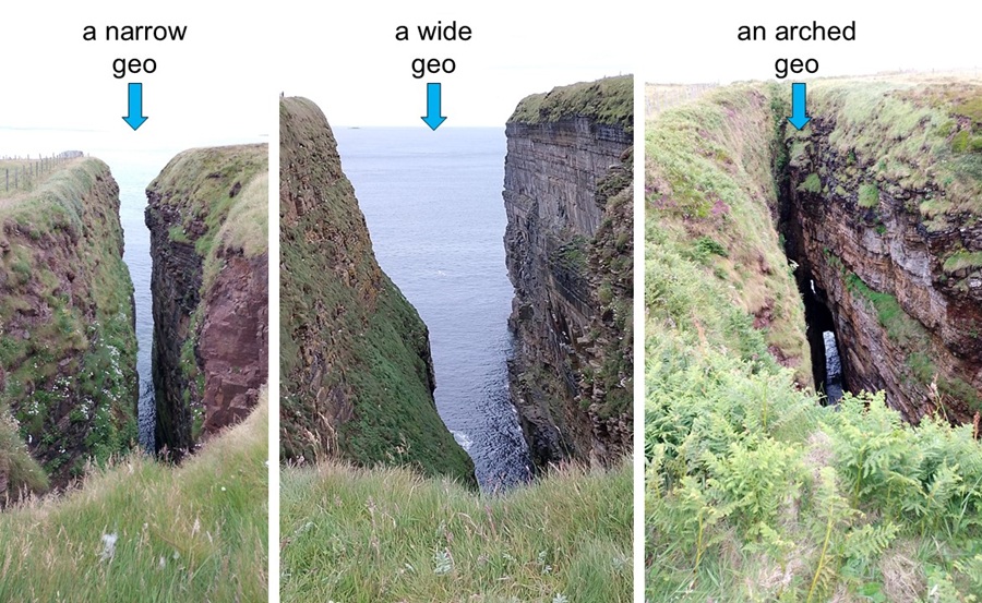
| The rest of our walk was focused on all shapes of geos (a narrow and deep cleft in the cliff face). There were always sea birds nesting in them. Some geos were very narrow, some where quite wide, and some had arches where you could spot the sea all the way at the bottom. | |||||||||||||||||||||||||||||||||||||||||||||||||||||||||||||||
|
|||||||||||||||||||||||||||||||||||||||||||||||||||||||||||||||
|
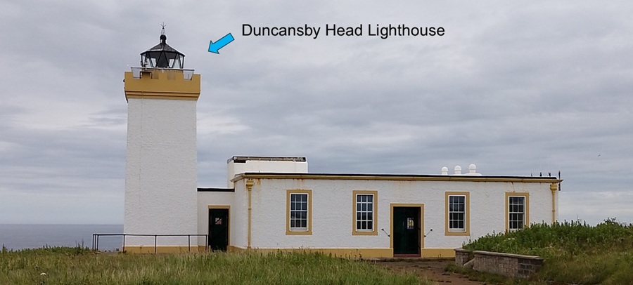
We reached Duncansby Head Lighthouse where a lot of other people
were enjoying the view. They had arrived by bus and car, but we felt happy
about the walk.
The lighthouse is still in use, but it was automated in 1997. It was built in 1924 by David Alan Stevenson. Building lighthouses was in his genes. Lighthouse-geeks will know his brother, uncle and grandfather. Others may know his father author Robert Louis Stevenson who wrote Treasure Island, Dr Jekyll and Mr Hyde, and more. |
|||||||||||||||||||||||||||||||||||||||||||||||||||||||||||||||
|
|||||||||||||||||||||||||||||||||||||||||||||||||||||||||||||||
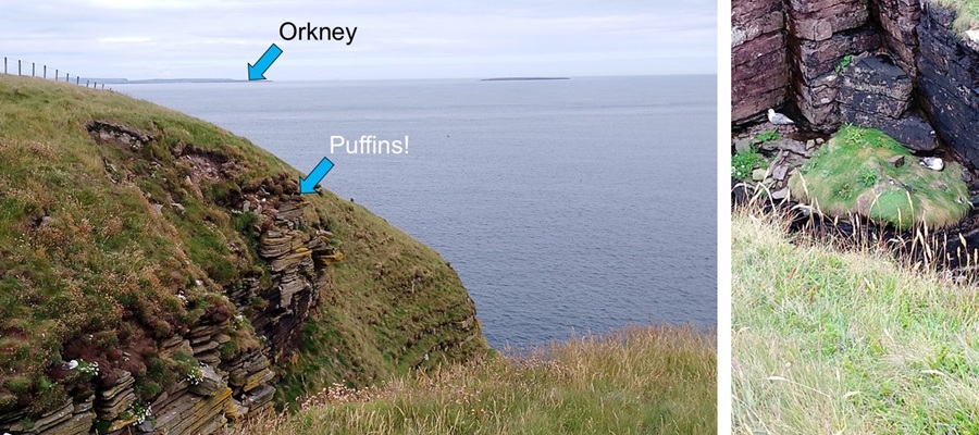
| While lighthouses are useful and fun, we kept hiking to see the nearby Duncansby Stacks. On our way south towards the stacks we stopped at every geo we could find. And would you know it: we found more puffins! Hooray! It was easier to get photos of the "normal" sea birds as they were nesting nearer to the trail. Puffins were perched near their burrows just outside reach of our camera phone lenses. You'll have to believe us: they were there - cute as buttons. | |||||||||||||||||||||||||||||||||||||||||||||||||||||||||||||||
|
|||||||||||||||||||||||||||||||||||||||||||||||||||||||||||||||
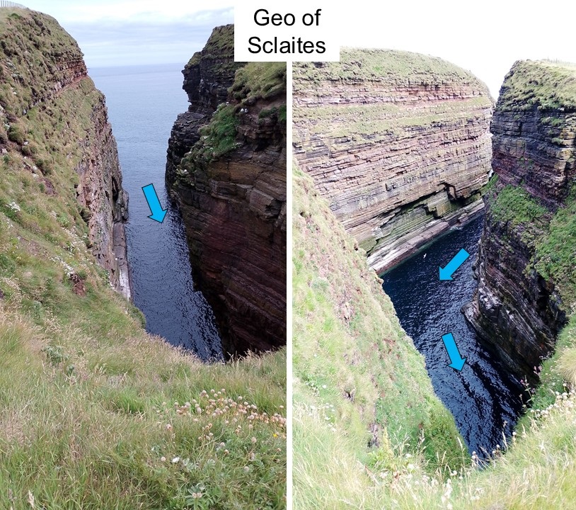
| On our route was also the giant geo of Sclaites, with a bend in it. So much space for so many birds. Smell and noise accordingly... | |||||||||||||||||||||||||||||||||||||||||||||||||||||||||||||||
|
|||||||||||||||||||||||||||||||||||||||||||||||||||||||||||||||
|
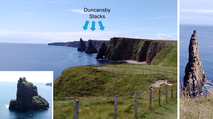
Finally we spotted the Duncansby Stacks. Impressive-looking rock formations
that remain un-eroded. Tall and pointy with plenty of space for nesting
and loud sea birds. One of them had a very photogenic arch cut through
the base of it.
From one angle, we think it looks like Madonna doing backstroke. |
|||||||||||||||||||||||||||||||||||||||||||||||||||||||||||||||
|
|||||||||||||||||||||||||||||||||||||||||||||||||||||||||||||||
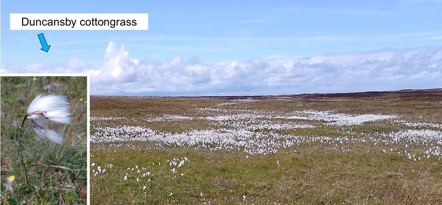
| The marshes along our trail were covered in cottongrass. | |||||||||||||||||||||||||||||||||||||||||||||||||||||||||||||||
|
|||||||||||||||||||||||||||||||||||||||||||||||||||||||||||||||
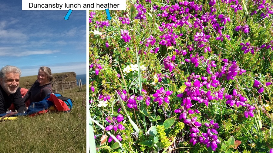
| When we sat down to enjoy our picnic lunch and cup of tea there were beautiful patches of flowering heather too. Nice view of the cliffs at Duncansby Head. | |||||||||||||||||||||||||||||||||||||||||||||||||||||||||||||||
|
|||||||||||||||||||||||||||||||||||||||||||||||||||||||||||||||
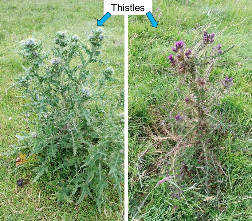
| Along our trail were also many thistles clearly left behind as grazing livestock chose better options. When we asked Google, these two very different thistles could be: Spear Thistle and Marsh Thistle. | |||||||||||||||||||||||||||||||||||||||||||||||||||||||||||||||
|
|||||||||||||||||||||||||||||||||||||||||||||||||||||||||||||||
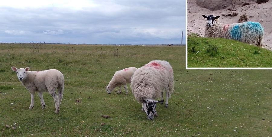
| On our return route to Percy, still waiting at John O'Groats, we learnt that the local sheep are not as scared as Shetland sheep. Most of them seemed to have calmed down after that stressful worming event and were grazing without taking much notice of us. One poor sheep must have gotten into the paint bucket! | |||||||||||||||||||||||||||||||||||||||||||||||||||||||||||||||
|
|||||||||||||||||||||||||||||||||||||||||||||||||||||||||||||||
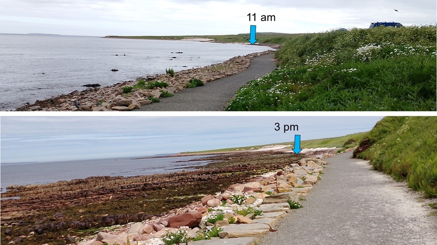
| The sea along our trail was not much lower at 3 pm than when we left at 11 am. It doesn't show on our photos, but the sea looked odd, like it was boiling, so we're thinking that must be the danger of the Pentland Firth - or just our imagination. | |||||||||||||||||||||||||||||||||||||||||||||||||||||||||||||||
|
|||||||||||||||||||||||||||||||||||||||||||||||||||||||||||||||
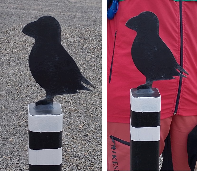
| Back at the car park we found these cute puffin ornaments on top of bollards. Even more visible against Hild's red jacket. | |||||||||||||||||||||||||||||||||||||||||||||||||||||||||||||||
|
|||||||||||||||||||||||||||||||||||||||||||||||||||||||||||||||
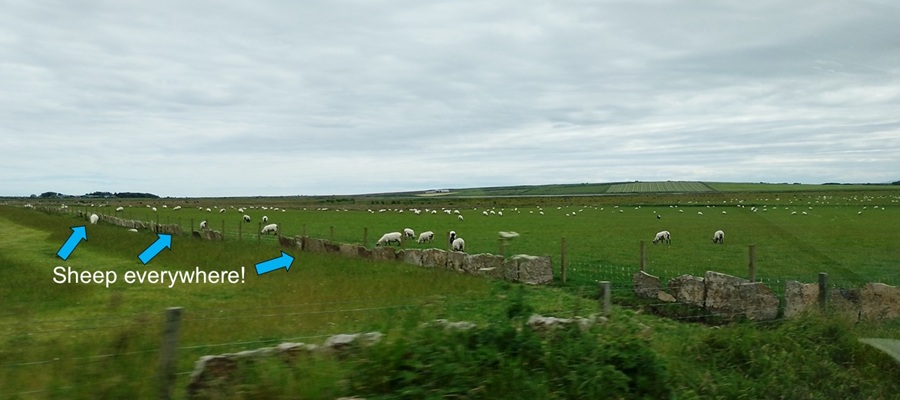
| We took a different - more rural - route back to the campsite. There was a lot of sheep in most fields. | |||||||||||||||||||||||||||||||||||||||||||||||||||||||||||||||
|
|||||||||||||||||||||||||||||||||||||||||||||||||||||||||||||||
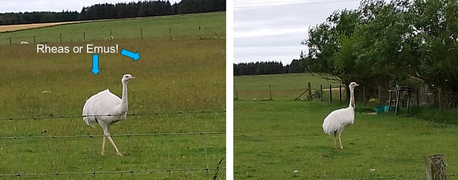
| This route also helped us get a new species on our list. Our first guess was that it was a herd of emus, but some further searching says it may be rheas. If anyone knows, please tell us. | |||||||||||||||||||||||||||||||||||||||||||||||||||||||||||||||
|
|||||||||||||||||||||||||||||||||||||||||||||||||||||||||||||||
| It had been a long day, so we returned to our tent quite ready for a rest, some dinner, some work, and then lots of sleep. | |||||||||||||||||||||||||||||||||||||||||||||||||||||||||||||||
| Coming up: Day of work in Thurso | |||||||||||||||||||||||||||||||||||||||||||||||||||||||||||||||
Start
| To Previous Day
| To Next Day
| Nerdy
| Stranger Things
| Stairs Stairs Stairs
May-July 2025
May-July 2025