

Rob-n-Hild, oot and aboot eh? Sorry - 2022
|
Click links to jump to specific days: Start | Nerdy | The Largest... | Ornaments
|
|||||||||||||||||||||||||||||||||||||||||||||||||||||||||||||||
|
Fort Frances - Red Rock (539 km, driving time: 7 hours 23 minutes, max elevation: 512m) 
|
|||||||||||||||||||||||||||||||||||||||||||||||||||||||||||||||
|
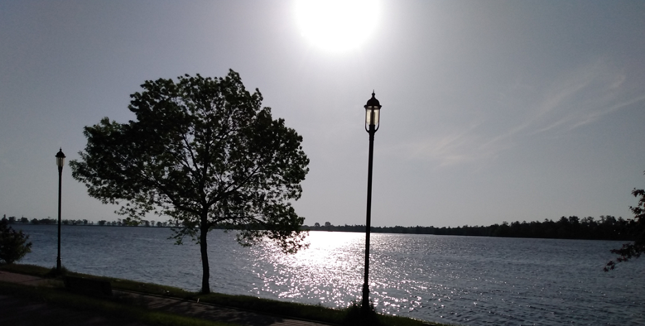
We got up early and almost saw the sunrise over Fort Frances. On our way out
we saw lots of homes with sandbags keeping the flooding river. The quesiton is
how often does it flood and maybe people should build some permanent berms?
We weren't able to capture photos, but the flood and marshy land seemed to have swallowed telegraph poles so they had become very short or leaning/collapsed. In one case it was the trees holding up the wires! |
|||||||||||||||||||||||||||||||||||||||||||||||||||||||||||||||
|
|||||||||||||||||||||||||||||||||||||||||||||||||||||||||||||||
|
As so many times before on this trip, we were stopped for roadworks.
Today we had a fun guy with his stop sign - doing a super-hero pose to stop the cars. I
guess you have to make your job fun.... Gave us a good laugh at least!
On our to-do-list since driving from Thunder Bay to Kenora, we were finally able to complete the task to take photo of the marker for the arctic watershed. Going west, the water flows north into the Arctic Ocean. Going east, the water flows south into the Atlantic Ocean. |
|||||||||||||||||||||||||||||||||||||||||||||||||||||||||||||||

|
|||||||||||||||||||||||||||||||||||||||||||||||||||||||||||||||
|
We had already filled up with gas in Fort Frances, but we did stop
as planned at the Shell station near Reef Point Road. It probably isn't
the largest we have seen, but still cute to take photo of.
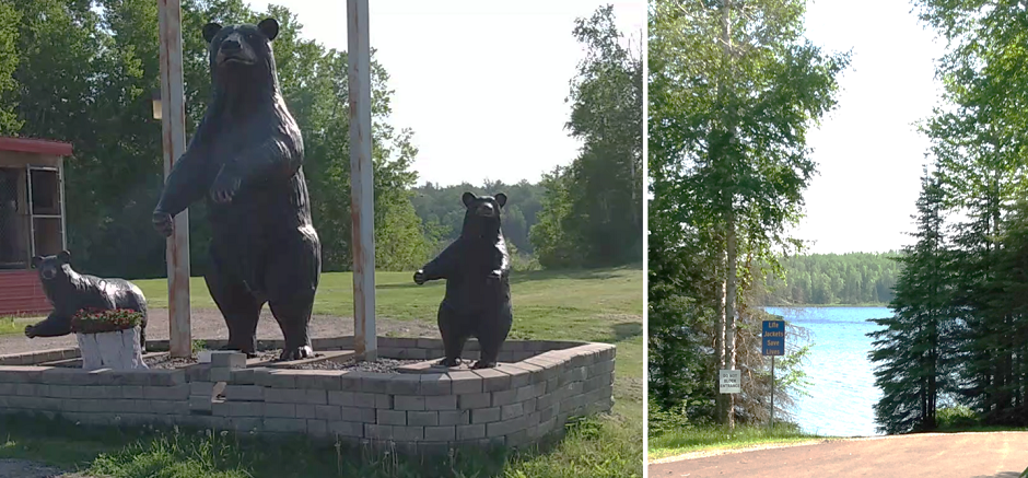
We also made an spontaneous bio-break stop at Lake Aramis picnic area, which turned out to be quote scenic with a boat launch and all. |
|||||||||||||||||||||||||||||||||||||||||||||||||||||||||||||||
|
|||||||||||||||||||||||||||||||||||||||||||||||||||||||||||||||
| Without a themometer we have not been able to document temperature fluctuations on this trip. It would have been fun to do. We could have used it today: we set off from Fort Frances and got to 32 degrees before we climbed over the last line of hills before Thunder Bay. Then it to 15 degrees in Thunder Bay and as low as 12 at one stage, then warming up again as we drove higher away from the lake. Something to pack for next time - a temperature recorder like our dear departed Eloise. | |||||||||||||||||||||||||||||||||||||||||||||||||||||||||||||||
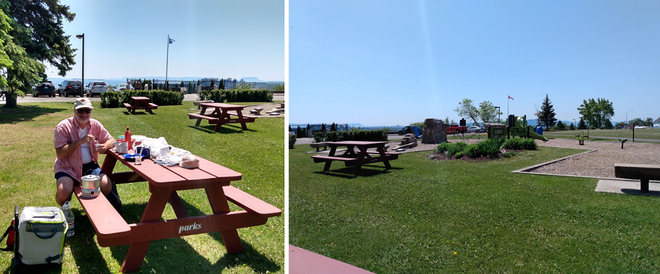
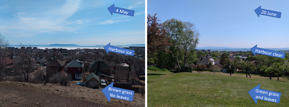
| One must always plan ahead to find a picnic spot - and so we did. Today timing was perfect to stop at Hillcrest Park in Thunder Bay. We liked the view when were were here in May and wanted to return to see the changes 6 weeks can cause. | |||||||||||||||||||||||||||||||||||||||||||||||||||||||||||||||
|
|||||||||||||||||||||||||||||||||||||||||||||||||||||||||||||||
| Back in May the inner harbour was still frozen, the grass was brown and there were no leaves on the trees and bushes. Today we had warm sun, the boats were busy travelling in the harbour, the grass was green, and trees and bushes were lush. | |||||||||||||||||||||||||||||||||||||||||||||||||||||||||||||||
|
|||||||||||||||||||||||||||||||||||||||||||||||||||||||||||||||
| Next we set our sights on Sleeping Giant Provincial Park and Silver Islet. The road in along the peninsula was fun and brought sights of train bridges high up in the air and oh so many more lakes. We were confused as we thought the peninsula was only wide enough for the road and Lake Superior on one side and Thunder Bay Harbour on the other. We were wrong. It is huge and wide! | |||||||||||||||||||||||||||||||||||||||||||||||||||||||||||||||

|
|||||||||||||||||||||||||||||||||||||||||||||||||||||||||||||||
|
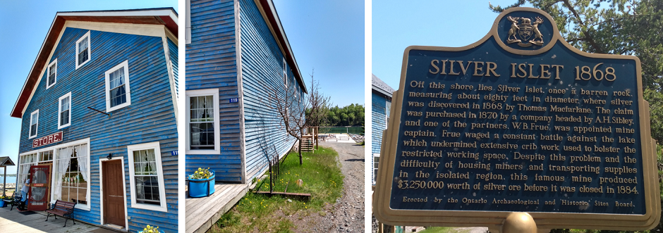
First we drove all the way through to Silver Islet. Hild wanted to shop for gifts but,
while the general store was established in 1871, it was sadly closed today.
We got to speak with the manager who happened to be mowing the lawn.
The manager gave us a run-down of the history in the area including the silver mine. Between 1870 to 1884 the mine at Silver Islet produced $3.25 million worth of silver - or approximately $97 million in 2022 dollars. That is pretty amazing. He also advised us that the frontage road around Silver Islet is not closed as it says on the map (although maybe they close it when it gets too busy with visitors). The locals are only here in the summer - living in houses originally built for miners. Six of these people are apparently hardy enough to survive the harsh Lake Superior winters and stay here year-round. |
|||||||||||||||||||||||||||||||||||||||||||||||||||||||||||||||

|
|||||||||||||||||||||||||||||||||||||||||||||||||||||||||||||||
| There would have been so much more to explore in the area with lots of islands and tours available later in the season. We, however had to keep going. | |||||||||||||||||||||||||||||||||||||||||||||||||||||||||||||||
|
|||||||||||||||||||||||||||||||||||||||||||||||||||||||||||||||
|
Thank you to Cathlyn and Richard for recommending we take this detour.
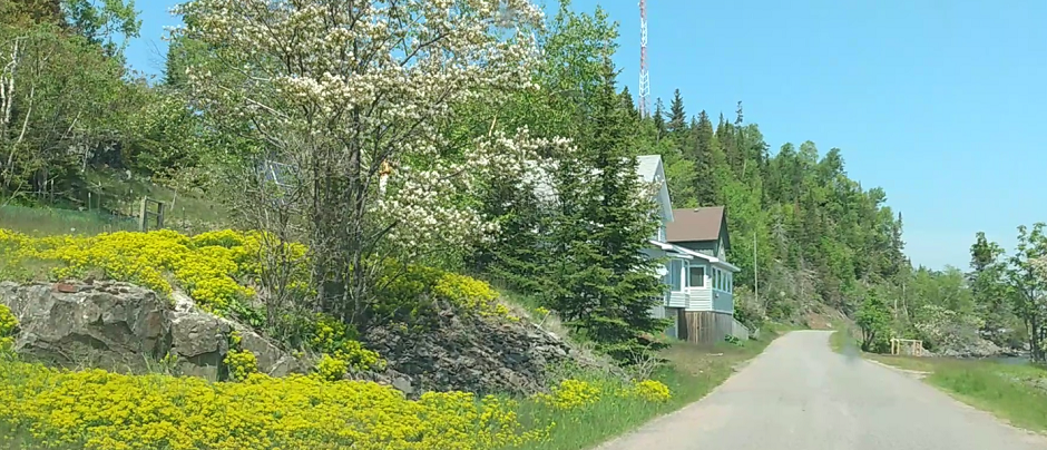
It is undeniably beautiful in Silver Islet. Cute houses line the shore. Of course we can see that on a sunny warm day like today it is OK, but when the winter weather comes off Lake Superior these houses will take the first hit. Our slow drive reminded us of a Virtual Corner Cafe we had with our condo neighbours, Donna and Alexis, last year. We "drove" along this road together on WebEx using Google Street View. It was fun then, and it was fun to repeat the route in real-life today! |
|||||||||||||||||||||||||||||||||||||||||||||||||||||||||||||||

|
|||||||||||||||||||||||||||||||||||||||||||||||||||||||||||||||
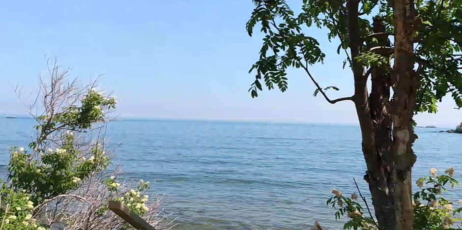
| The view from old wooden camps (Donna taught us to say "camps" not "cottages") across the lake was very relaxing today and a walk on their cute little beach was perfect. | |||||||||||||||||||||||||||||||||||||||||||||||||||||||||||||||


|
|||||||||||||||||||||||||||||||||||||||||||||||||||||||||||||||
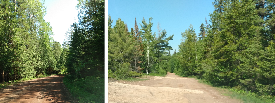
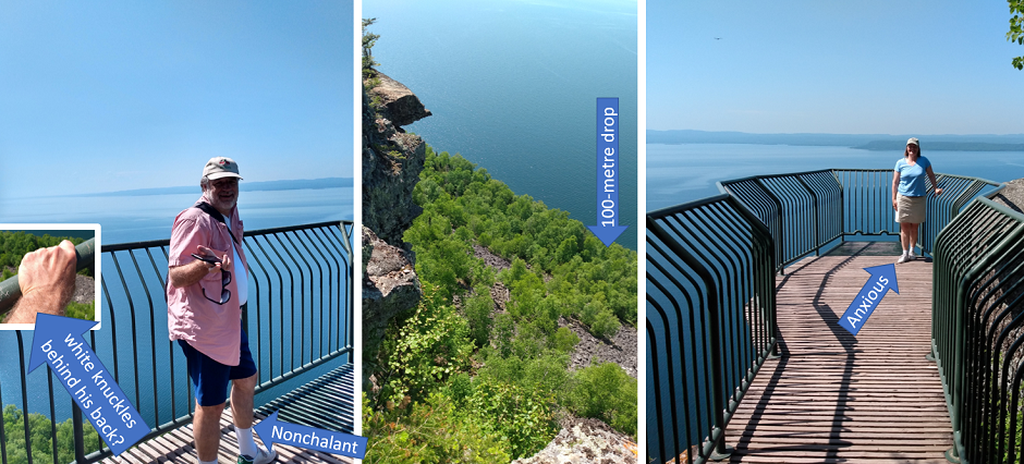
| Cathlyn and Richard - and now the store manager - had recommended that we make another detour. This time to the Thunder Bay Lookout. We were warned that the road would be gravel and a bit rough especially towards the end when it turns into just driving across granite rock! Well, Mary Jane has been through a lot and she was game to try this one too. It turned out fine, although we parked her a bit short of the end-point as the granite surfaces were getting quite bumpy. | |||||||||||||||||||||||||||||||||||||||||||||||||||||||||||||||
|
|||||||||||||||||||||||||||||||||||||||||||||||||||||||||||||||
| The view was great - and scary with the 100-metre drop below our platform. Thank goodness for the sturdy railing! Rob looked quite nonchalant until he revealed he was holding the railing white-knuckle-tight... Hild did not try to hide her fear of heights, but she got quite far out on the platform too. | |||||||||||||||||||||||||||||||||||||||||||||||||||||||||||||||
|
|||||||||||||||||||||||||||||||||||||||||||||||||||||||||||||||
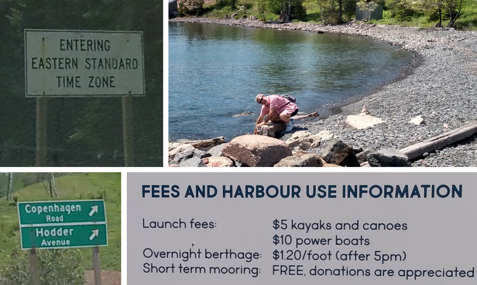
Of peculiar items today we had:
|
|||||||||||||||||||||||||||||||||||||||||||||||||||||||||||||||
|
|||||||||||||||||||||||||||||||||||||||||||||||||||||||||||||||
| As we drove closer to Red Rock, we received lots of messages from the Red Rock Inn to let us know that "the" restaurant in Red Rock is closed on Mondays so there is nowhere to eat! OK for us as we are always well-stocked, but "the" restaurant? Is there nowhere else to eat in this town? Apparently not..... It was nice of them to let us know. | |||||||||||||||||||||||||||||||||||||||||||||||||||||||||||||||
|
The manager at Red Rock Inn told us all about his wildlife friends: bear,
squirrel, fox and lynx.
The bear shows up in town every Wednesday because it knows it is garbage day
in Red Rock. The squirrel loves the peanuts left for him - so much we
watched him fight off two giant crows to keep it all to himself. The fox
wanders through whenever it feels like it. And the lynx comes right up onto
the veranda and looks in through the lobby doors.
Maybe the lynx just wants to play on the original tabletop hockey game we spotted. The fun part of this discovery is that the game was developed by Bill Kobayashi, Vivian's relative, when he worked at Eagle Toys back in the 50s! We met Bill in Ottawa a few years back - and he was so lovely. Click to read about Bill Kobayashi |
|||||||||||||||||||||||||||||||||||||||||||||||||||||||||||||||

|
|||||||||||||||||||||||||||||||||||||||||||||||||||||||||||||||
|
Coming up: Driving from Red Rock to Kapuskasing. | Start | Nerdy | The Largest... | Ornaments | Go To Previous Day | Go To Next Day |
|||||||||||||||||||||||||||||||||||||||||||||||||||||||||||||||
May/June 2022

