
|
Intro Map Day 1 Day 2 Day 3 Day 4 Day 5 Day 6 Day 7 Day 8 Day 9 Day 10 Day 11 Day 12 Day 13 Day 14 Days 15-18 Day 19 Day 20 Day 21 Day 22 Day 23 Day 24 Day 25 Day 26 Day 27 Day 28 Nominations Nerdy Pages |
Broome Broome Broome Day 23 Manning Gorge - Broome Hi again everyone, I hope you got my last message which was a long time coming I know, but I do need a bit of help sending these messages - I need Hild or Rob to check into somewhere nice with a 'phone so I can get them off to you. And that is where we are now - the Moonlight Bay apartments in Broome, in a nice double apartment (with a spa!) so I've sent off the last stuff and with a bit of luck this one can get off before we check out. Well, you might think what we are doing here in Broome when last night we were at Manning Gorge, well - we drove here of course. Rather a lot of driving in the end, but once we got onto the sealed road we made good time, and decided to push on to Broome once we realised that it was going to be dark before we could put the tent up anyway. So we thought that a night somewhere comfy (with a 'phone for me and a spa for the humans) would be justified.
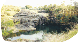
We still did lots, 'cos we got up really early and went on the walk to the top of Manning Gorge just as it was getting light. A good idea to wait until we could see 'cos the markers were pretty hard to follow. We had been told to look for pink ribbons, rock cairns or cans and to go around the edge of the lake. Sounds good? Well, it was actually a bit harder than that 'cos there were ribbons everywhere and there were two lakes, joined by a bit of stream which had to be crossed, but which could be crossed at any one of a number of places (most marked by some kind of ribbon). So we got lost and went too far first time, but realised pretty soon afterwards and got back on track.
It was actually rather a good walk, but the rather idiosyncratic marking and the distance - 'about an hour' - a bit vague. I know we've mentioned this before, but it really doesn't help to say 'about an hour' when there are so many different interpretations. This one turned out to be quite accurate, but it is a bit difficult to know what to expect each time. Anyway, the pools at the top were lovely and - had we had more time and inclination - been very good swimming. The falls weren't very big - but they never are at this time of year. It was the style we had seen previously at El Questro and Emma Gorges in that a water fall has gouged out a plunge pool and the the gorge carries on from there.
Well, on the walk back we saw a few people who were miffed that they weren't the first (lazy bones - hey should have got up earlier) and then saw a lady who had swum across the lower lake as a short cut while her companions (or relatives or something) had walked around only now she couldn't find them, so we walked back around looking for them but we reckoned they must have got lost around the bottom of the lake. We finished packing up and got away by about 8.30 on our way towards Windjana Gorge. There are a lot of other gorges around here and you could easily spend a lot of time going up to each one, Bells Gorge for example is supposed to be really nice but is 40 - 50 k off the main road. Not having a week to look at just one area, we knew we would miss lots, but then we wouldn't have any reason to come back here would we? So, on to Windjana, we left the Gibb River Road and took the road towards Fitzroy Crossing which goes via both Windjana and Tunnel creek.
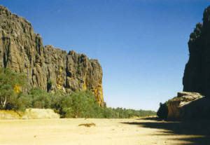
Windjana Gorge is quite different from the other gorges we had seen. For a start, it doesn't end (or start if you are looking from the river's point of view) in a waterfall, but is just a gorge going straight through a range which simply rises out of the surrounding plain and is about 3.5 k long going straight through the range. We didn't walk the whole way through 'cos it was rather hot (just after lunch) and after the first k or so we had seen lots of crocodiles and birds and fish so we turned around. The crocs were particularly docile with most of them just sunning themselves on the sand even when a nice juicy little girl walked up to take a photo, but she was Belgian and maybe the croc knew that. In fact they were so unmoving that Rob suggested they were dummies put there by CALM to discourage people from swimming and give them something to photograph, then one of them moved so at least some of them are real.
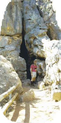
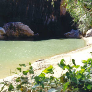
So, we had 'done' Windjana Gorge - the next was Tunnel Creek. This is a hole underneath another range rising out of the plain. These ridges are all that remains of a coral reef barrier from the original sea-floor and are very interesting to look at 'cos there are fun patterns in the rock. We took lots of photo's of these and then we ran out of film in Hild's camera which is the only one with a flash so we didn't bother to walk the whole tunnel. Well, actually it was because those two humans wimped out again and didn't fancy wading up to their knees in the dark! There you go again you see - without me and my spotties they can't go anywhere in the dark! It was a bit iffy though, 'cos there were lots of rocks to climb across and then wading through dark water is not all that pleasant an experience - I've never understood what those cave divers see in it at all apart from an unusual way of killing themselves.
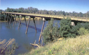
So after wimping out again, we carried on and hit the sealed road between Fitzroy Crossing and Derby at about 3.30. This is where the decision was taken to push on to Broome. We could have stopped there or somewhere along there and camped, but it was already 5.30 when we reached the first camp-site at a roadhouse where we met the Broome-Derby road and only another 170 k to Broome so we carried on. We did cross the Fitzroy river before it got dark and even in the dry season this looks good. Not much water now, but you can see the power of the river for about 2 kilometres, with the road about 20 m above the ground and a series of floodways extending out into the surrounding plain. This is still cattle country (as Hild can attest to - having to stop or slow down quite often when there were cows and calves close to or on the road) and we wondered what they do when the water rises, I hope the farmers round them up and move them away from the river 'cos there doesn't seem to be any high ground for them to get on to.
It got dark after that so we haven't seen anything of Broome yet, but the apartment is very nice and we only had to stop at two places to find somewhere to stay. Maybe we are on a roll now and the days of no room at the inn are over. Of course it could be something to do with the fact that school holidays are over in WA now. At least we think so because Murdoch started back today and UWA went back last week. That should get rid of some of the tourists at least. Now that we are on major roads for a bit we will probably see more traffic so getting rid of a few caravans will be very welcome. Tomorrow we will check out Broome, but not for long 'cos we would like to get down past Port Hedland on our way towards Newman by the evening. It looks like we will miss out on Marble Bar as that is another 2-300 k of gravel road which can be a lot slower depending on conditions. I know it seems like we are missing out on bits, but there is so much to see and we have to make some hard choices. We really want to spend a bit of time in the Hamersley Range (Karajini National Park) after we have a look at some of the big mines in and around Newman. This is an area where better means bigger and some of the stats look impressive. The Shire of East Pilbara, for example, is bigger than the state of Victoria or the whole of the UK! So, when we next send messages we'll be able to tell you what big is like! Bye for now. Lionel |


