
Seven Sisters Cliffs - Feb 2025
| Seven Sisters Cliffs | |
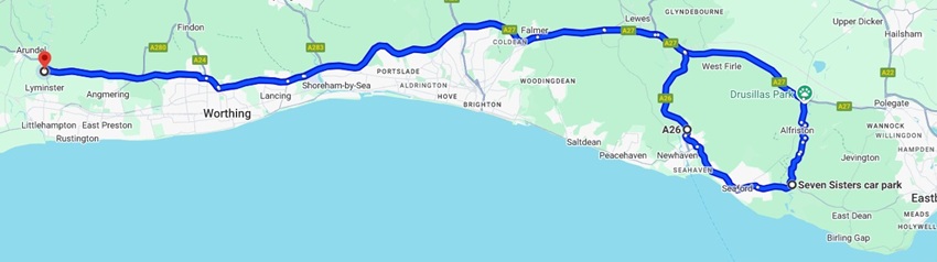
| During our weekend trip, we made a day trip from our hotel in Arundel to see the Seven Sisters cliffs. The drive took an hour each way. On the way out we took this rather slow and muddy route through Alfriston, and on the way back we went a somewhat faster route through Newhaven. Looking back, we probably should have taken a more scenic route and at least driven through the famous seaside town of Brighton. But we were tired and had work to do.... | |
|
|
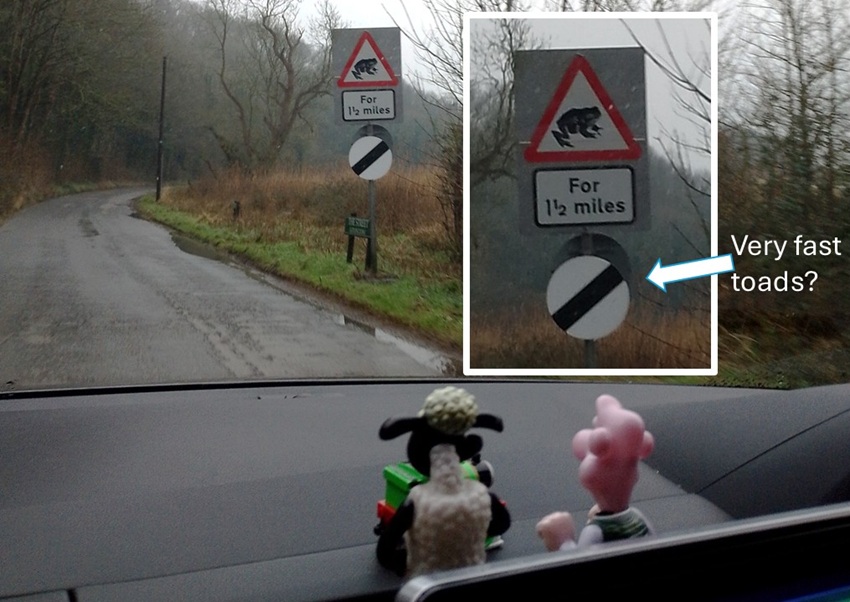
| Driving through Alfriston and Litlington we were frequently reminded to mind the toads crossing the road. They even had special road signs with toads on them! Interestingly, these must be fast toads since at the same time the speed limit was lifted to the national maximum of 60 mph (100 km/h). Our dashboard friends (Percy, Wallace, Gromit and Shawn, all found it very funny). | |
|
|
|
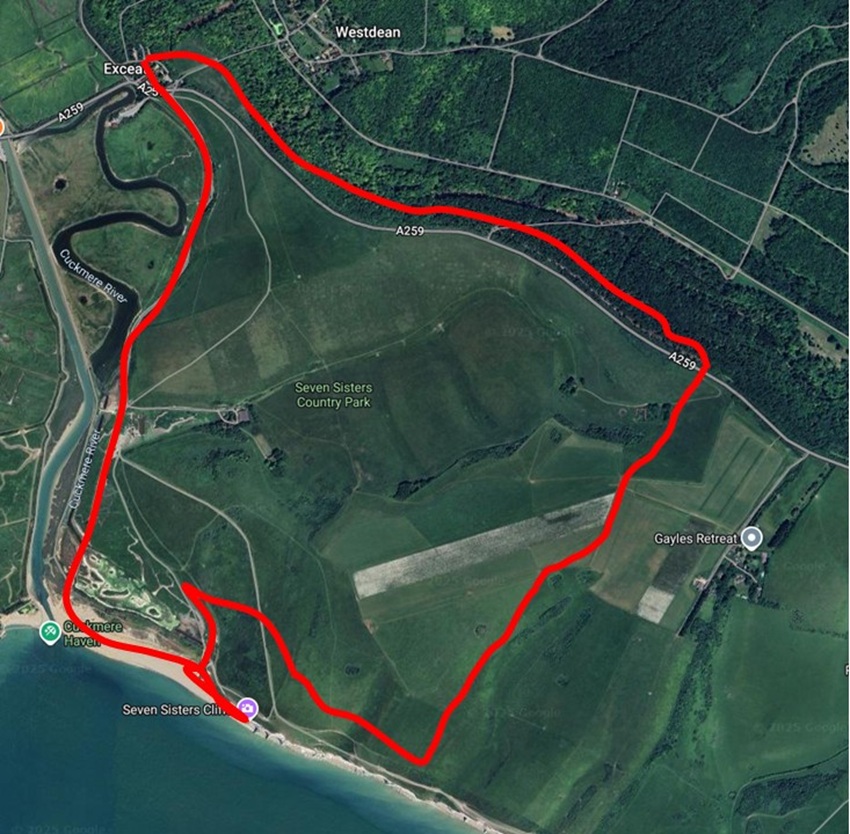
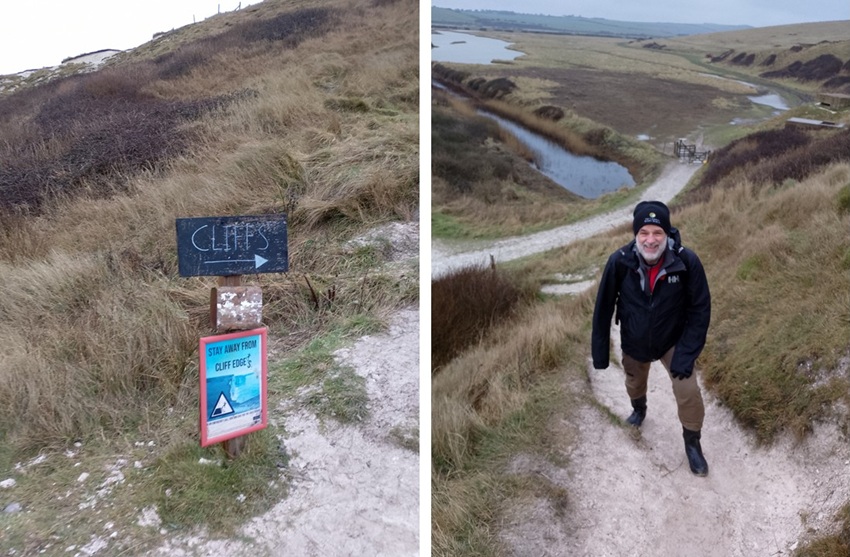
We parked Percy at the northern car park at Seven Sisters visitor centre. They have nice facilities with cafe,
hotel, gift shop, as well as public toilets and picnic tables. Paying GBP 4.9 for a full day parking is a
good deal.
We plotted our route to start off going down to the beach to view the cliffs from below. It was drizzling and windy when we arrived so we weren't sure how far we would hike. But the weather cleared up and we also climbed the trails up to the top of the cliffs, across pastures and through the forest back to the car park. Having forgotten to bring the GPS watch we don't know exactly the distance and altitude we hiked, but it was approximately 4.5 miles (7.5 km) in 3 hours. |
|
|
|
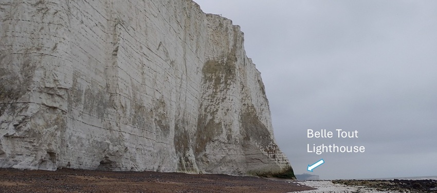
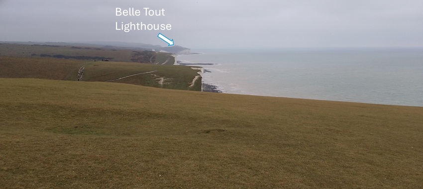
| When we arrived at the beach by Cuckmere River and the salt flats, we were amazed how white and tall the cliffs are. The beach is full of large and small pebbles making for quite an energetic walk. The tide was going out so we could get a good view eastward along the beach - all the way to Belle Tout Lighthouse (we think). | |
|
|
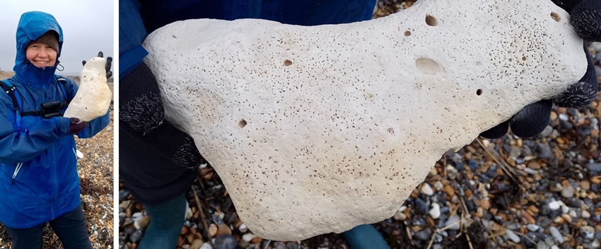
| Hild was fascinated by the chalk stones. Big and small pieces scattered on the beach below the cliffs. This made us mindful of potential for rockfalls - so we planned not to linger for too long close to the cliffs. | |
|
|
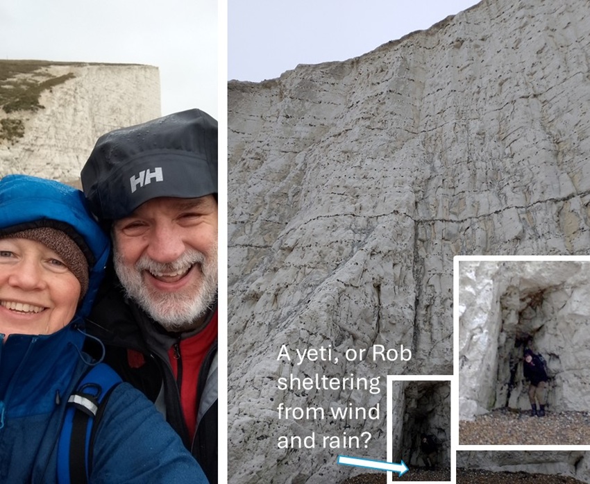
| We were so happy to have made the trip and to see the cliffs up close. The wind was whipping us around a bit and Rob checked out a little gap in the cliff for potential shelter and tea making stop. We decided against it - see earlier comment about rockfalls... | |
|
|
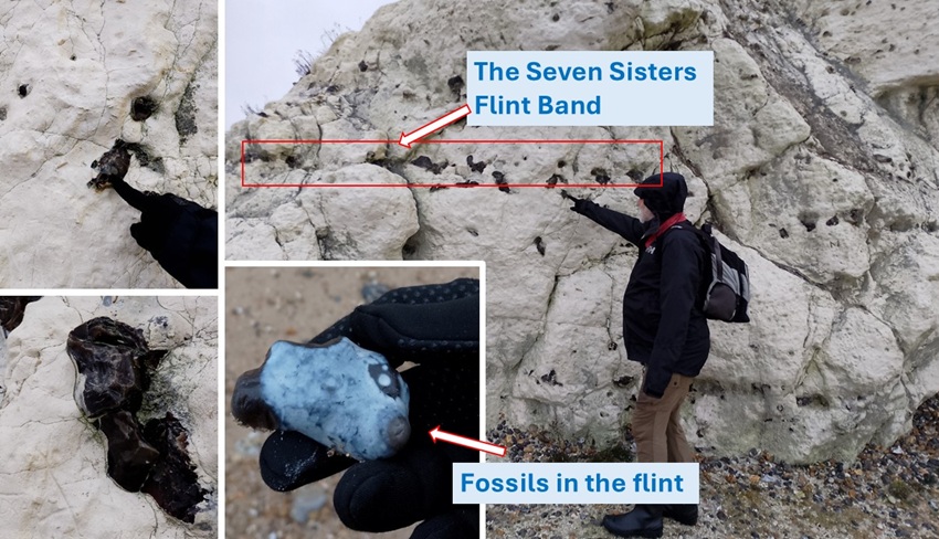
| Rob was pointing out the very shiny black layers in the cliff face. After some research we learnt that: The black layers are known as the "Seven Sisters Flint Band" and can be spotted all along the cliffs and beach. Flint is made of quartz crystals developed from sea sponges and micro-organisms that died and settled on the ocean floor within the sedimentary chalk limestone. Sometimes one can find fossils protruding from the flint/chalk, and we think we did... (to be confirmed by geologist). | |
|
|
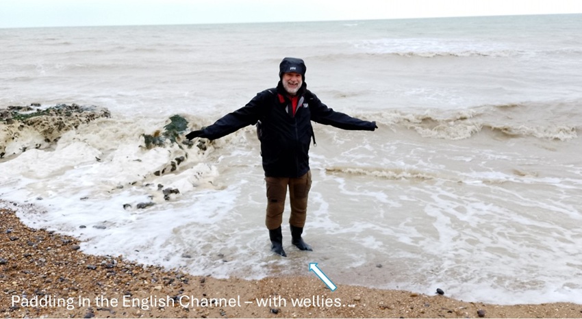
| Before making our way back off the beach, Rob wanted to paddle in the English Channel. Hild thought for a moment that he was serious and was going to go barefoot into the surf. Nope - paddling with wellies today! | |
|
|
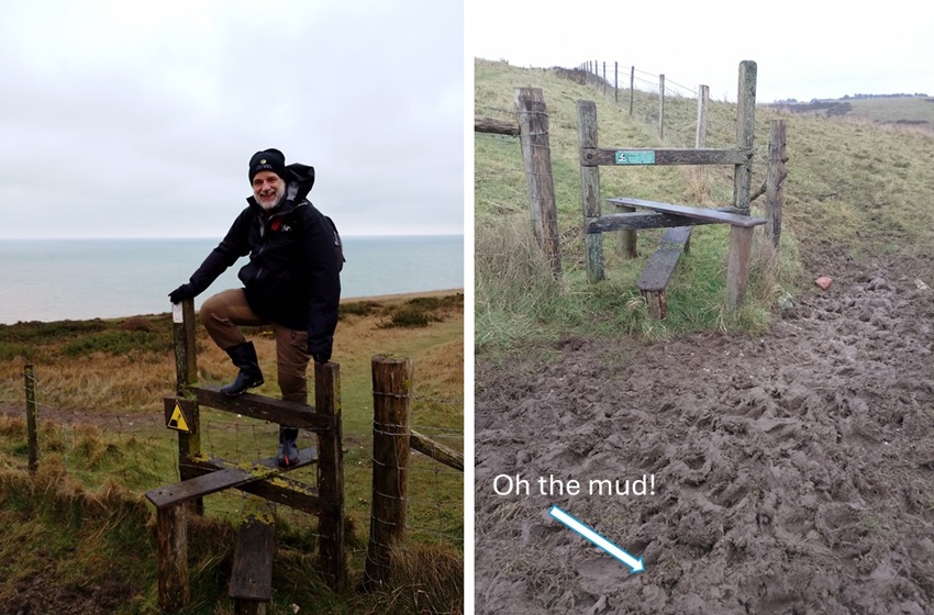
| Various warning signs were telling us to stay away from the cliff edge and also where it was safe(-ish) to climb up to the top. Luckily, we found that the chalk limestone surfaces were not slippery. We were only sliding around in sections where there was still soil and grass cover. It was quite an exhausting climb, but we did it! | |
|
|
| At the top we got lovely views both west toward Cuckmere River and ... | |

|
|
| east toward what we think is Belle Tout Lighthouse. | |
|
|
| We did not want to hike that far, so we consulted the AllTrails application on Hild's phone. With the help of the map we found our way across farmers' fields where cows were grazing. Mind you, they were grazing in the distance away from us. All we had to deal with was lots of cow dung and oh so much mud at the stiles where we could climb fences. | |
|
|
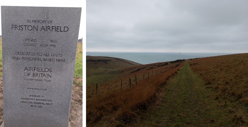
| As we crossed various fields we enjoyed the rolling landscape - finding it much steeper than in Somerset. We also came across a monument commemorating that it was an airfield leading up to and during the 2nd world war. | |
|
|
|
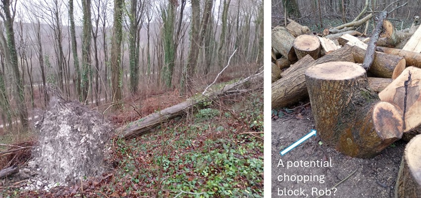
We made it back to the main road and crossed quickly into a forested area.
There was plenty of evidence of wind having blown over trees and efforts had been made
to clear up the mess. When were not surprised when we saw how little soil the poor trees were hanging on to
- and all the limestone was not helping much either.
Rob's latest fascination and responsibility for chopping wood at home lead him to see potential chopping blocks in every downed tree. The only problem was that they were too heavy to carry back to Percy. |
|
|
|
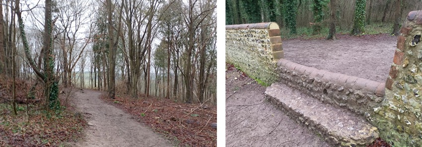
| The trail through the forest was easy even if a bit muddy. There were less fences/stiles to climb and this stone wall was purpose built for us to jump across very easily. | |
|
|
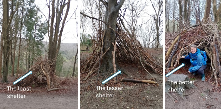
| Further along, children (we're guessing) had made the most out of downed trees to practice making shelters. We inspected and were quite impressed with one of them, while the others needed more work and wood. | |
|
|
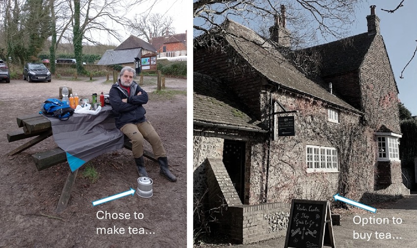
| We returned to the car park at lunch time. Everyone else were opting to buy lunch, coffee, and tea at the cafe. We however, surprise surprise, chose to make our own and enjoy a picnic in the fresh and chilly air. A wonderful end to a great day. | |
|
|
|
We did it! We wore our wellies AND we needed them! |
February 2025