
Rivers Brue, Parrett and Huntspill- Mar 2025
| Hiking along Rivers Brue, Parrett and Huntspill | |
|
Last time we walked in this direction we had to turn around because we didn't
want to disturb grazing cows. This time we were hoping that they were elsewhere.
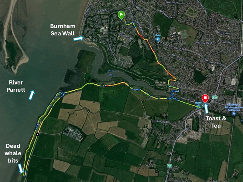
By the time we returned home, we had hiked 10.2 km in 1 hour and 47 minutes. That excludes a stop at the Purple Spoon for toast and tea break. It is flat here by the sea, so we only climbed 40 metres. | |
|
|
|
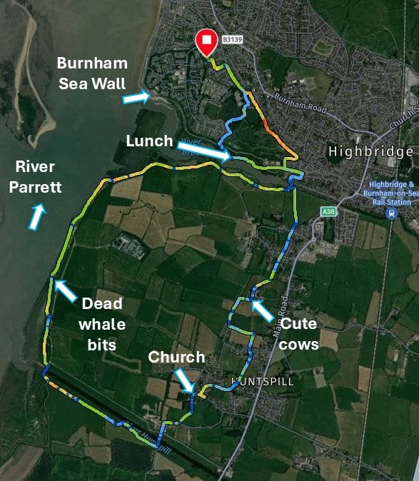
A few days later, we decided to set off on the same route but complete it by hiking
all the way to Huntspill River and cut back through villages to Burnham without
having to walk along the busy A38. That route was 12.1 km long and it took
us 3 hours and 52 minutes although we sat down for 40 minutes for our lunch.
In a good mash-up we include photos from both hikes below. | |
|
|
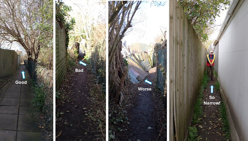
| After we got through the village and Apex Park we stepped onto the England Coast Path toward Bridgwater. The path went up against people's tall garden fences and started off in good condition on flagstones. Then it became a dirt track, and some fences had fallen. By the end most fence panels had collapsed. Towards the end, the path was so narrow that Rob had to walk sideways or squeeze through between the fences. It felt good to get out the other end. | |
|
|
|
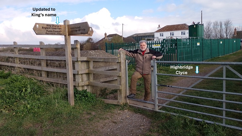
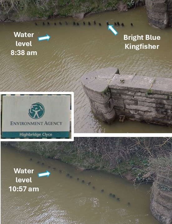
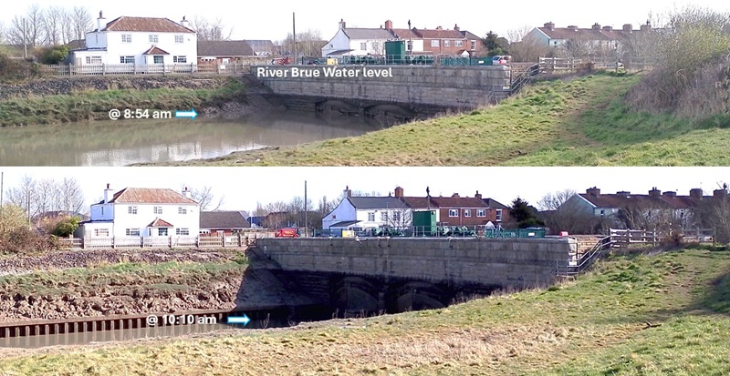
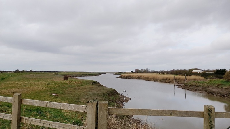
We crossed over the Highbridge Clyce, which is a flood gate where several public paths
join. The clyces in the area were built in the 1200s for flood control. The control
gradually changed the marshes and levels from saline sea marsh to freshwater lagoons and bogs.
We noted that the public path sign has been updated from Queen Elizabeth to King Charles. | |
|
|
| On the northern side of the clyce there are some poles on which Rob was lucky to spot a bright blue kingfisher bird. We tried to take photos and video, but the cameras are just not good enough for this. At least we could see the difference in water level on our return later in the morning. We could hear water rushing through openings in the flood gate for a short while until the openings were closed again. All part of flood and tide management. | |
|
|
| When we started walking along River Brue it was high tide, and the water level was right at the top of the clyce gates. By the time we returned an hour later, the water level had dropped considerably. | |
|
|
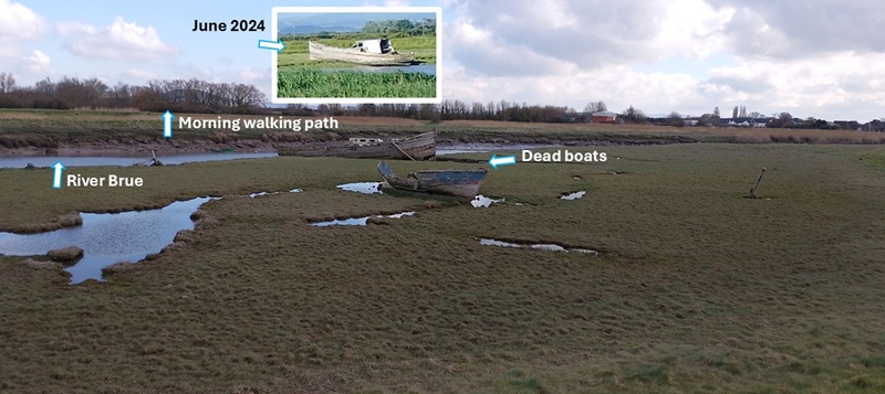
| We often find ourselves taking photos of these two dead boats from the other side of River Brue - where we walk every morning. Comparing it to a photo from June 2024 shows how much the big boat has deteriorated in 9 months. Much of the damage came during the big storm (Darragh) on 7th December 2024. | |
|
|
|
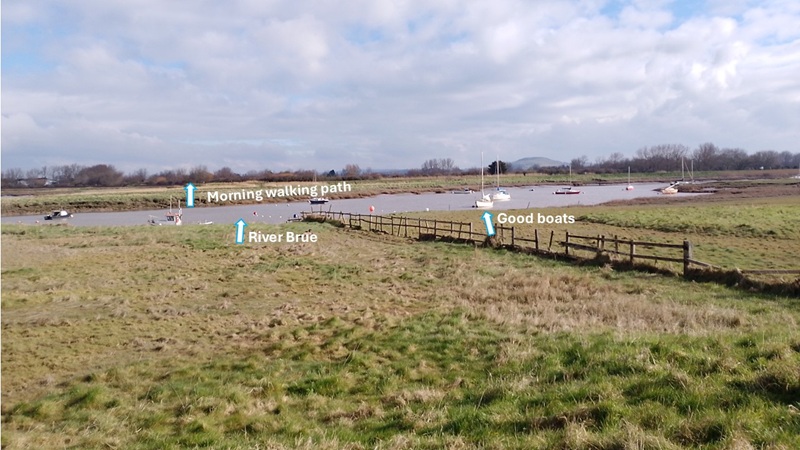
The boats further down River Brue were in good condition although we don't
often catch them being used.
Apparently, the river was used as an extensive harbour in Roman and Saxon times. Then in the medieval period it was silted up and couldn't be used. It was opened again in the 1800s. In the 1900s the wharf on Huntspill River took over and River Brue as a port was closed in 1949. | |
|
|
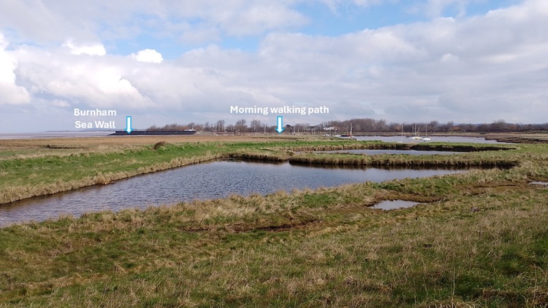
| As we got to where River Brue runs out into River Parrett, we also saw Burnham Sea Wall - a familiar walking route for us: every morning! | |
|
|
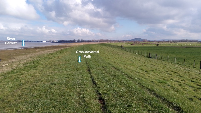
| The hike along River Parrett was very comfortable on a grass-covered path. There were several sheep with little lambs in nearby fields, but they just ignored us. | |
|
|
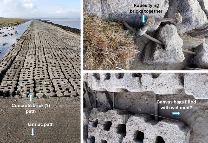
| Next the path turned into a tarmac covered road. We did not expect that. Then suddenly a section was covered in concrete bricks tied together with rope and laid out on what seemed to be canvas bags filled with wet mud. Research has not turned up what has led to this invention. It was unsettling to walk on these bricks because they move up and down and make squelching noises! | |
|
|
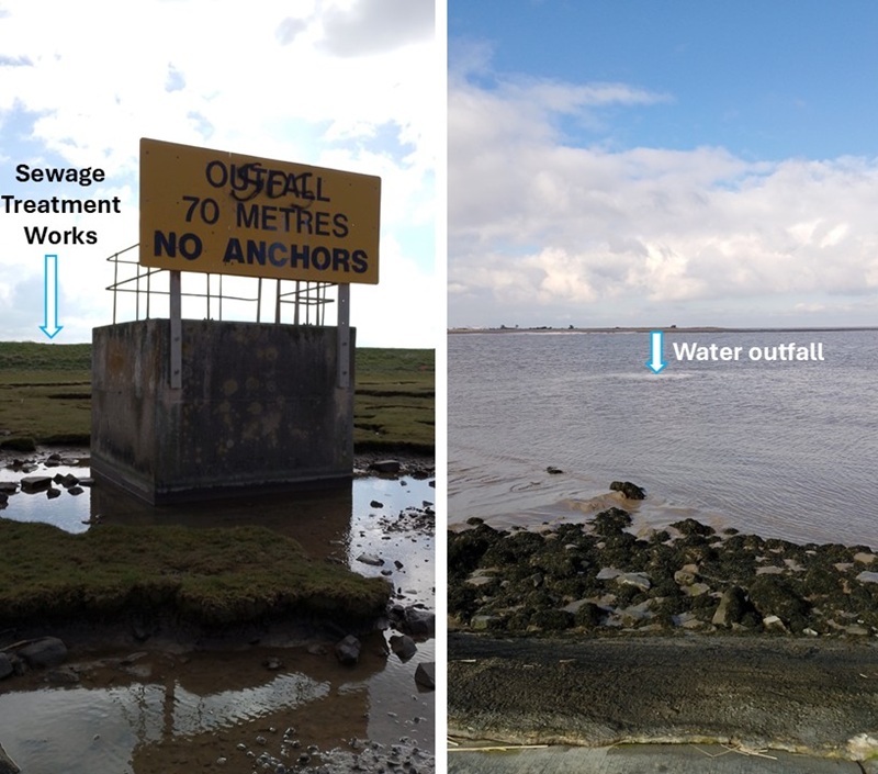
| We came across a sign notifying boats that there is an outfall and that the boats must not use anchors. Looking out onto the river we could see the water bubbling up. This is related to the West Huntspill Sewage Treatment Works on the other side of the dyke. | |
|
|
|
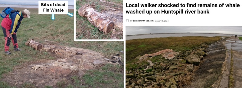
Just short of River Huntspill, at the side of the trail, there were some bits of dead whale.
We first noticed the large vertebrae, and that the carcass was still "juicy".
Hild poked it with her boot, as she would, only to find out that it is also
still very smelly! So we left quickly.
Some research in local newspaper indicates that it is most likely a dead Fin whale that died in October 2023 and washed up in Portlock Weir. It was 50 feet long and started decomposing. Since then bits of the whale has floated up the coast. The Fin whale is the second biggest after the Blue whale, and it is known as the Greyhound of the Sea. | |
|
|
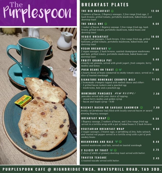
| On our first walk, we turned around at this point and walked back the same way. By the time we were back at Burnham Clyce, we felt it was time for a break, so we did a detour into Highbridge to visit the Purplespoon Cafe at the YMCA. Tea with toast and toasted teacake did the trick! We also had a chat with Liz and her friends who were running their "Repair Cafe" at the Purplespoon. | |
|
|
|
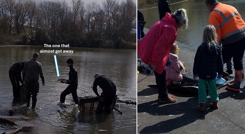
On the way home through Apex Park, we noticed a team of people
working nets in the lake and carrying fish up into big buckets on land.
Research shows that Highbridge Angling Association regularly moves fish
from the boating lake back into the fishing lake. These fish have escaped
through the nets into the safety of the boating lake where no fishing is allowed.
Today a little girl was allowed to hold one of the fish while parents took photos. She was warned that she would get all slimy and smelly - and she didn't mind. Well done! | |
|
|
| On our second walk, we continued past the bits of dead whale along the Parrett until we reached River Huntspill. We decided to cross the Huntspill over the sluice. It was a very tight squeeze to get through to the other side. We learnt that a sluice is the same as a clyce/clyse, the latter being mainly used on the Somerset Levels. The Somerset Levels are coastal plain and wetlands between the Mendips and Blackdown Hills on the border with Devon. | |
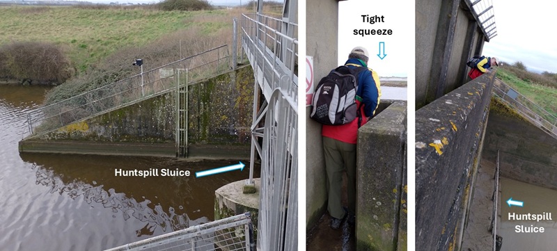
|
|
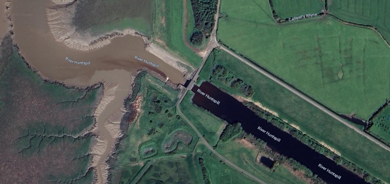
| And again - so much mud on the sea-side of the sluice. On the other side of the sluice the water was surprisingly clear. This is very noticeable on Google satellite photo of the sluice. | |
|
|
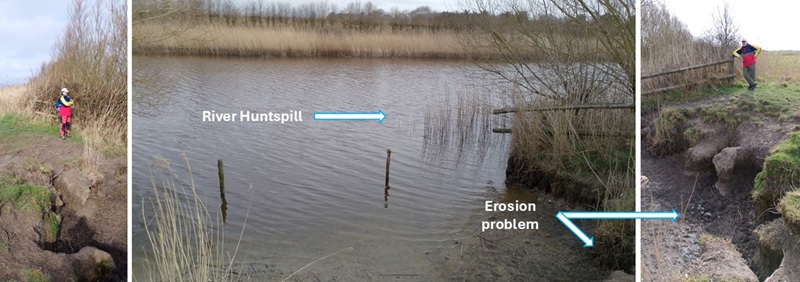
| The trail along River Huntspill was an easy gravel track, but it was quite far away from the river. When we got a chance, we nipped over to have a look. At this point there was quite a lot of erosion making access to the river tricky. Still, the water was nice and clear. | |
|
|
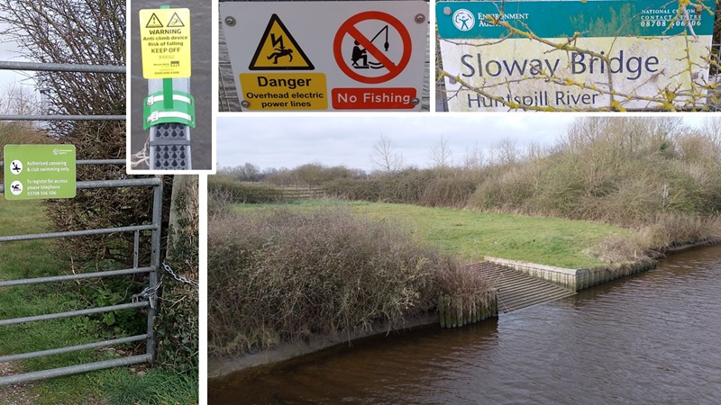
| When we crossed the river again at Sloway Bridge there was even a nice access point for swimming and canoeing - if you register with a club, that is. The use is limited by various signs saying no jumping, climbing, or fishing. | |
|
|
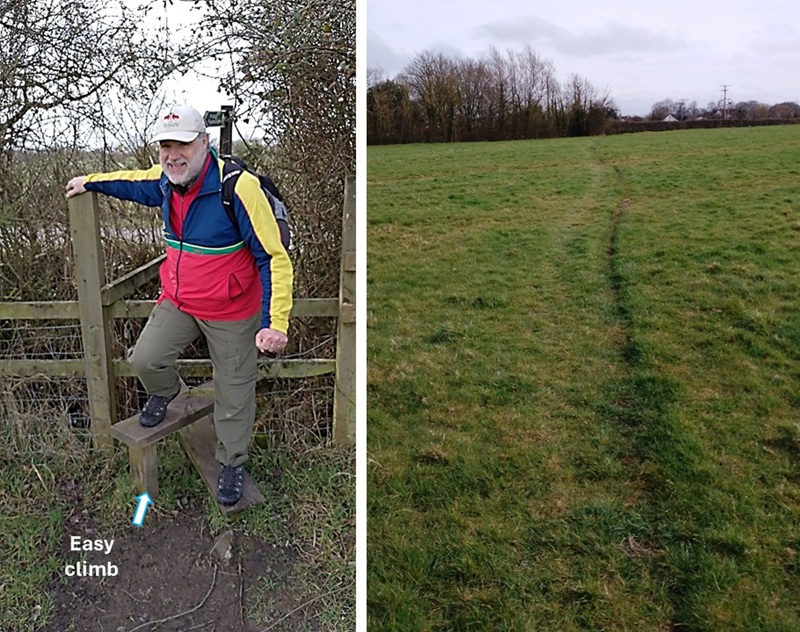
| We are not big fans of crossing fields on our hikes, but sometimes that public path signs indicates it is OK. This fence stile was very nicely designed with a cross-piece for an easy climb. | |
|
|
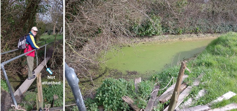
| At the other end of the field, we crossed a one-plank bridge. It was made from cement so it was sturdy - something you couldn't say about the railings! The ditch itself was suffering from water with a large nutrient imbalance. | |
|
|
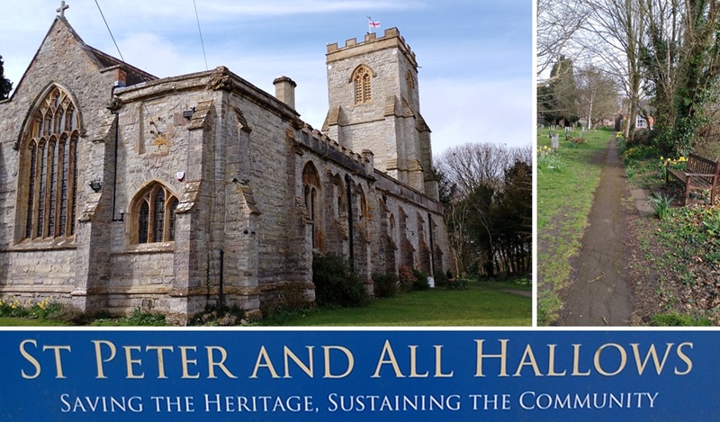
| We enjoyed a walk around St Peter and All Hallows church in Huntspill. It was built in the 13th century, and their list of Rectors goes back to 1278. Then the roof and furniture were destroyed by fire in 1878 leaving only the walls standing. It was restored to what we saw today. There is an honesty cafe inside the church every day 10 am - 4 pm and toilets are available too. Donations are welcome. | |
|
|
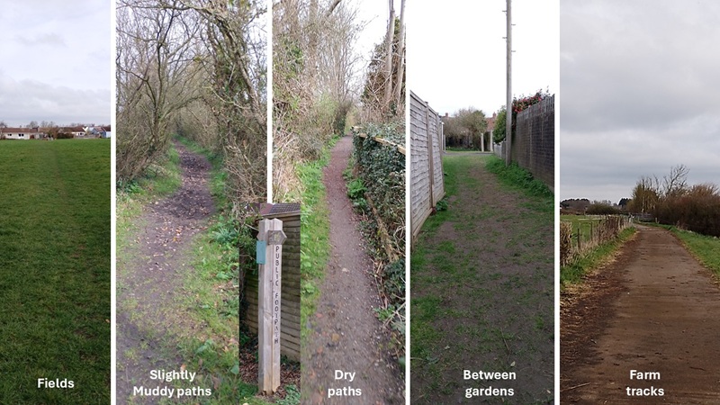
| Our trail map lead us along Silver Street to a walking path all the way back to Burnham. It varied from crossing fields, slightly muddy paths, mainly dry paths, sometimes squeezing in between garden fences, and sometimes along farm tracks. The good thing for us was that there were markers for public footpaths all along. | |
|
|
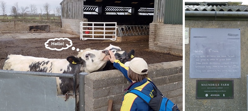
| The public footpath went through Maundrils Farm. However, we felt welcome because they had a notice board up informing hikers about this week's farm activities and that calving time is approaching. Hild got to say Hello to some of the friendlier cows. | |
|
|
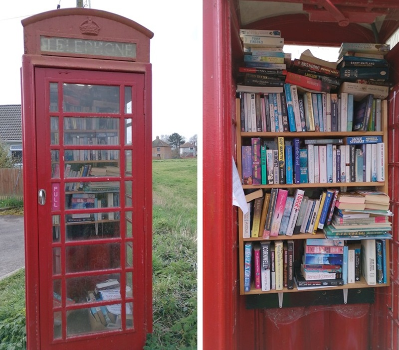
| At the outskirts of Alstone, we found this old red telephone box - now used as a community library. It was nice because there is space for many books, and they were all kept dry. | |
|
|
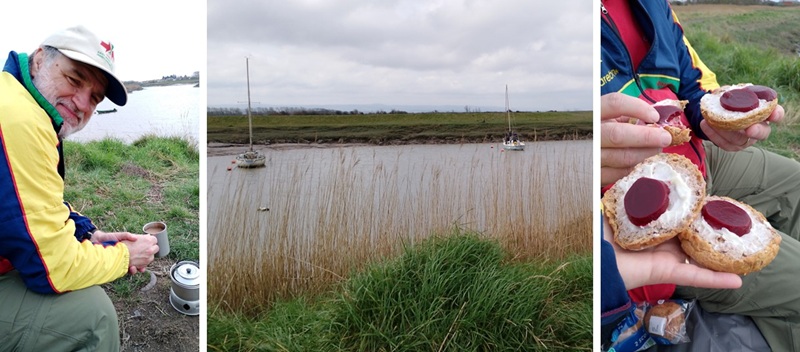
| When we returned to River Brue, the water level was up again, and we were tired. It was time to find somewhere to sit down and have lunch and a cup of tea. | |
|
|
| We enjoyed the convenience of a park bench (covered with our groundsheet). It was a peaceful view over the boats on the river, while eating our liver pate, mayo, and beetroot sandwiches. And - of course - a cut of tea: Enjoying a brew on the Brue. | |
|
|
|
Postscript: It was a day for hiking boots and that worked well. In wetter weather wellies may be needed for some sections. |
March 2025